Trail of Mt. Serra
Trail for families
- Trail Conditions: On foot
- Interest: Flora, Wildlife, Panorama, Religion
- Departure: Loc. Aia di Cacio, Rio nell'Elba
- Arrival: Loc. Aia di Cacio, Rio nell'Elba
- Duration: 1 hour/s
- Difficulty Level: for families
- Length: 2.4 km
- Difference in height: Uphill 140m
This short loop walk begins and ends at a spot known as Aia di Cacio, at a panoramic roadside parking area 2km from Rio nell'Elba. This is also the point of departure of path No 201 to the Nisporto beach, and a station along the GTE. The hike follows the loop path No 202 counterclockwise; the first stretch is flat and parallel to the entrance to the herb garden (Orto dei Semplici) of the Hermitage of Santa Caterina. After a short walk, the staple of its church can be seen among the cypresses. Follow the path on the south-eastern side of Mt. Serra, where vegetation grows low and sparse. In the summer, the shrubs of the daphne with their small white flowers are among the few blooming plants; their presence shows that the area has undergone wildfires. This plant, locally known as "patello", is toxic for fish, and was therefore used in the past to catch eels in the ditches. Before the path goes uphill, Torre del Giove becomes suddenly visible. Walk briefly on the watershed and you will reach the top of Mt. Serra, one of the island's best panoramic spots. In the late summer you may spot birds of prey migrating south, especially honey buzzards, marsh harriers, and peregrine falcons, that nest in the nearby cliffs. Follow the path along a watershed, where you may observe how the lentisk plants assume a rounded shape, to protect themselves from the wind.
Further information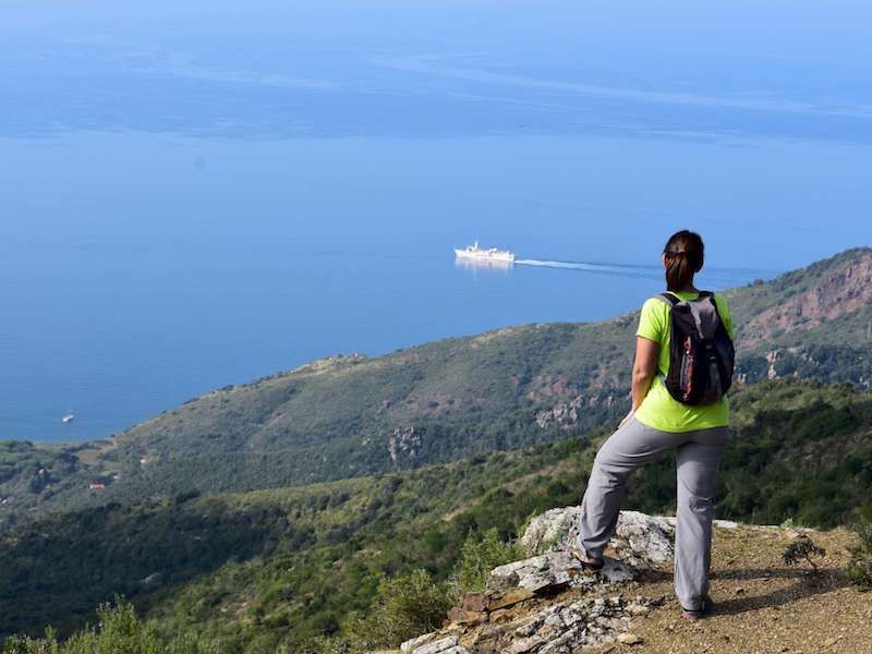
 Download KMZ