Alta Via del C.A.I. di Moggio
To be walked in two stages
- Trail Conditions: On foot
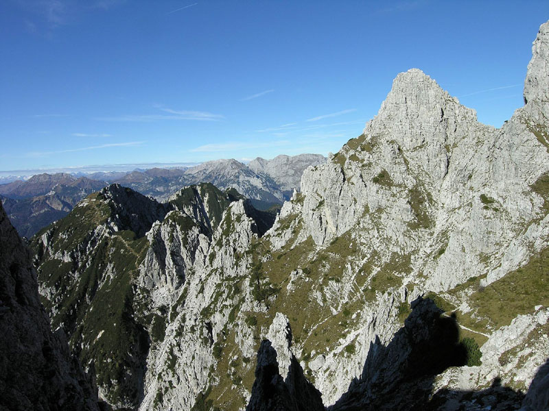
- Interest: Geology, Panorama, Hystory, Photography
- Difficulty Level: EE (Alpine level for the ascent to Çuc dal Bôr)
- Length: about 12 km
- Difference in hight:
1st stage - uphill 1,850 m, downhill 760 m, - 2nd stage - uphill 1,030 m (except for the climbing to the Çuc dal Bôr dome) downhill 2.320 m.
(total difference in height uphill: 2,880 m. Downhill: 3,080 m). - Average duration:
1st stage 7 hours,
2nd stage 8 hours (for a total of 15 hours). It takes two days to cover the whole itinerary, with overnight stay at the "G. Bianchi" bivouac. - Clothing: suitable for the season and for the high altitude, mountain shoes.
Suggested period: from (June) July to September (October). Consider the weather conditions carefully because especially on the ridges there are recurring lightning discharges (Çuc del Bôr and Cròstis ridges). It is recommended to cover the "Alta Via" in a north-south direction, starting from the vall'Aupa.
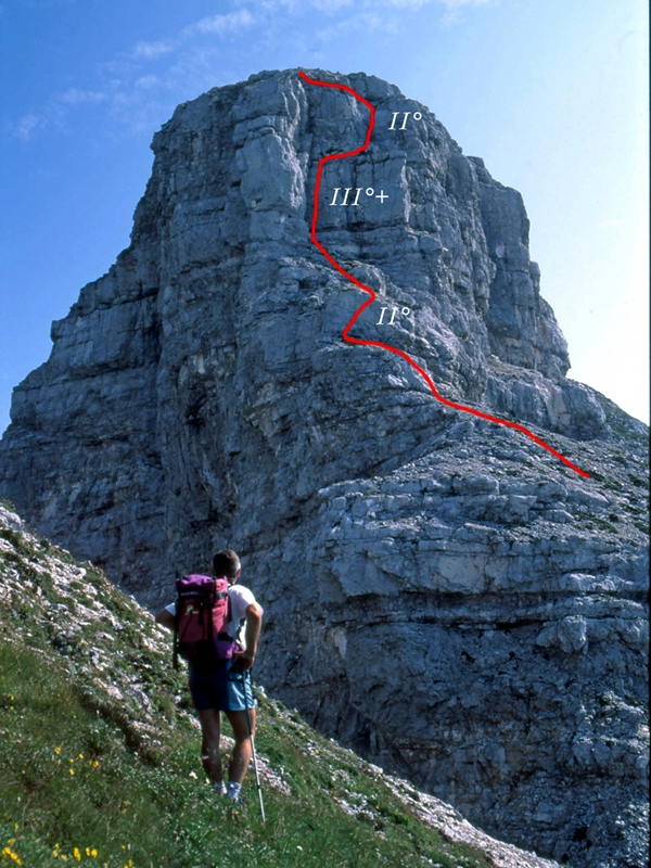
The itinerary can be considered as a summary of the whole territory of Val Alba. It has alpine features, and the deviations from the most frequented paths - which allow visitors to reach the summits - require stable feet, orienteering skills and a good mountain experience. On the ridges to reach the Çuc del Bôr there are some stretches where you need to use your hands to climb (1st level of alpine difficulty) and a good familiarity with the exposed stretches is required.
A topographic map and a good ability to assess the itinerary level are necessary. The only structure which allows to divide the itinerary into two sections is the "G. Bianchi" bivouac (9 beds).
Generally the itinerary, as far as its difficulty level and length are concerned, is recommended to expert, well trained hikers having a good knowledge of the mountains.
It is not recommended for hikers to climb the Çuc dal Bôr rise because it is necessary to well know how to use the equipment (ropes, carabiners etc…) in order to proceed safely.
It is not a ring-route, so it is necessary to park the cars at the arrival point to get back the cars left at the beginning. This itinerary was created in 1980 by the Moggio C.A.I. Section, which you have to contact to receive the summit stamps and the badge regarding the itinerary which covers the main summits of the whole Val Alba territory, developing in about 12 km to be walked in two different stages.
(Notes: besides the usual white-red path markers of the CAI paths, the stretches of the "Alta Via CAI Moggio" are also marked with yellow-red markers).
- Download
 Çuc dal Bôr via normale (PDF - 20Kb - Italian Text)