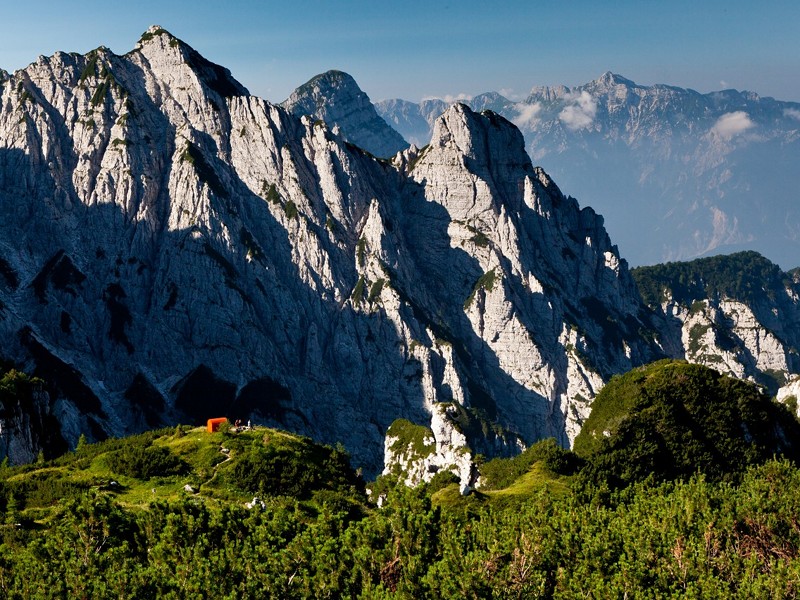
Climbing to the G. Bianchi Bivouac
- Trail Conditions: On foot
- Interest: Flora, Wildlife, Panorama, Photography
- Difference in height: 670 m uphill
- Difficulty level: for hikers (E), this itinerary has no particular difficulties, but a little training is necessary to walk the uphill stretches on well marked paths. Orienteering basics are also necessary.
- Average duration: from the parking area to the "G. Bianchi" bivouac it takes about 2 hours.
- Clothing: suitable for the season and for the high altitude, mountain shoes.
- Suggested period: the warmer seasons, especially during the late spring and autumn. In winter the snow might cause dangerous conditions because of snow slides and other mountaineering difficulties.
From Moggio follow the vall'Aupa provincial road (about 3 km) to reach upper Pradis. Then go on by car along the service road of the methane pipeline heading northwards, at the western foot of the Mount Maserèit (asphalt road) following the directions to the Val Alba Nature Reserve one reaches (after about 4 km) a small area used as a parking area (for a maximum of 15 cars), at an altitude of 1,050 m.
Leave the car and take a path on the right side of the parking area (until you reach the first crossroads with trail marker CAI n. 450) towards the stream Alba at an altitude of 1,042 meters (second crossroads). Then go uphill along a wide woody ridge up to a large mule track (1,200 m) leading to the "G. Bianchi" bivouac (trail marker CAI n. 428). The mule track goes beyond a short exposed stretch leading to the Cjavâlz hollow where the "G. Bianchi" bivouac is situated (1,712 m).