


Giovo - Pratorotondo
- Trail Conditions: On foot
- Departure: Giovo
- Arrival: Pratorotondo
- Duration: E
- Difference in height: 800m
19 lap of: Alta Via dei Monti Liguri
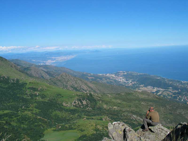
Panorama towards Genova - Loc. Pratorotondo
 Download KMZ
 Download the GPX format
Points of Interest
Books and Guides
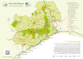

Protected Area(8.790,71 ha)

Lay-out of the itinerary

Departure

Arrival

Park Authority Offices

Visitor Centers (6)

Mountain huts/bivouacs* (1)

Municipalities (11)

Points of Interest (35)

Photos (20)

EV charge ≥100kW (286)

Airports (1)

Ports (1)

Station (4)
*: only Operators with Accommodation Page


© 2024 - Ente Parco del Beigua