

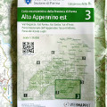
Hiking map no. 3 - Eastern Upper Apennines (Scale 1:25.000)
Val Baganza, Val Parma, Val Cedra, Val d'Enza. Appennino Tosco-Emiliano National Park, Parco dei Cento Laghi
Hiking map of the Province of Parma with routes by mountain bikeThe map scale chosen was 1:25.000, with front-back printing on waterproof, tear-proof and stain-resistant paper.
The excursion data (paths, stop places, mountain huts and bivouacs, water points) come from the "open" OPENSTREETMAP map database, into which the CAI section of Parma inserts and updates the data.
- ISBN: 9788894689693
- Size: 11x16,5 cm (closed)
- Year: 2022
- Scale: 1:25.000
- Price: 12.00 €
Hiking map no. 3 - Eastern Upper Apennines (Scale 1:25.000)


© 2024 - Ente di gestione per i Parchi e la Biodiversità - Emilia Occidentale