

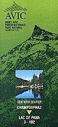
Champdepraz - Lac de Pana Guided Trail (trail marker 3-3c)
- Trail Conditions: On foot
- Interest: Flora, Panorama
- Departure: Champdepraz, località Lo Pian (560m)
- Arrival: Lac de Panaz
- Duration: 4.15 hours
- Difficulty Level: E - Hiking (level)
- Length: 7.7 km
- Difference in height: Uphill 1,302m
- Minimum Altitude: 560m
- Maximum Altitude: 1,880m
The trail crosses forests of downy oaks, chestnut trees, Scots pines, beech trees, mountain pines, and larches on its way to the gorge of Torrent Chalamy, the rural villages of Boden and Gettaz des Allemands, Pana pastures with the homonymous lake. Main features: forest variety, geomorphological features (river and glacial erosion), rural architecture, forest birds, the flora and fauna of the wetlands, and the beautiful view over Mt. Rosa and Mt. Cervino.
Books and Guides


© 2024 - Ente Parco Naturale Mont Avic