598-3 (AV5T 1) Cigoletta - Il Termine
- Trail Conditions: On foot, By bike
- Interest: Flora, Wildlife, Hystory
- Duration: 3 hour/s 15 minutes
- Return time: 3 hour/s 30 minutes
- Difficulty Level: E - Hiking (level)
- Length: 7.083 km
- Difference in height: 329m
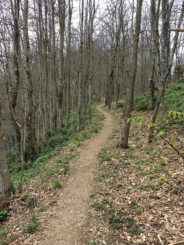
From Località Cigoletta take a first stretch of path common to 507 Vernazza - Riccò del Golfo. After a few tens of meters the path turns sharply to the right, starting a slight ascent. You then follow the path heading west on an unpaved road surface that is sometimes uneven on the ridge of the Cinque Terre, the border of the park. The vegetation is mainly wooded: chestnuts, Turkey oaks, deciduous broadleaves mixed with pine forests. Even during the day you can meet small wild animals. The path reaches the Malpertuso pass, the highest mountain in the Cinque Terre with its 815 meters.
Now begins a long descent that leads between chestnuts, oaks, holm oaks and pines, first at the intersection with an unpaved road (then paved), until the crossroads with the path 508 for Vernazza in Foce di Drignana.
Once passed the crossroads with the path no. 508 that descends to Vernazza, the path presents a slight ascent always passing through chestnut and holm oak woods. At a plateau, the path meets an intersection which, in a few minutes, leads to the church of Santa Croce with a splendid view of the sea. The path continues in a false plane and then downhill to Termine.
 Download KMZ