Points of Interest
Foresta Umbra
Foresta Umbra, stretching itself for 15,000 hectares in the heart of the Gargano,
is a mosaic of botanical species where the green patriarchs dominate:
specimens of beech, Turkey oak, holm oak, hornbeam, fir, and chestnut
tree with a monumental size. The whole forestal complex extends itself
from the about 300 meters of height to the 832 meters of Mt.
Iacotenente. This datum only partly justifies the great variety of the
essences composing it and of the associations they form.
The dark
soil in which the Foresta Umbra is rich is the result of a very slow
decomposition carried out by fungi, larvae, and xylophagous insects
feeding themselves with wood and other organic material. It is
necessary to wait some thousands of years for the formation of a
forestal dark soil of about 25 centimeters. The presence of the dark
soil makes the ground of the forest an extraordinarily suitable ground
for the growth of vegetation.
Tremiti Islands
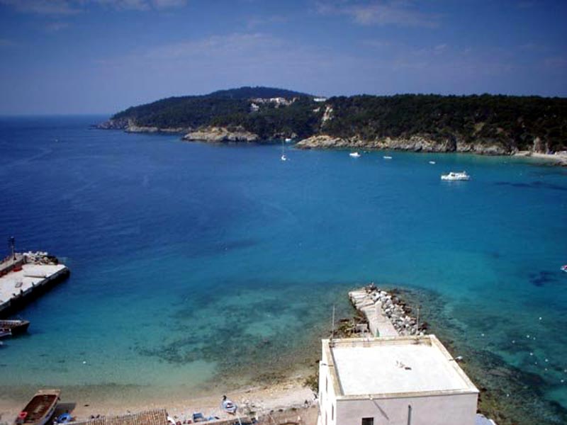
The archipelago of the Tremiti is 22 km far from the coast of Gargano,
and it is made of three main islands, San Domino, San Nicola and
Capraia, of the small island of Crepaccio and by several cliffs and
spikes. San Domino offers the visitors the charm of its caves, among
which the one of the Viole, with the walls covered by centauries and cinerarias, and the one of the Bue marino,
shelter of the monk seal. The island of Capraia is characterized by
several ravines and by a natural gallery made of calcareous rock which
preludes to a marine inlet, the Architello. The abandoned
island of Pianosa, caressed by the waves, has an extraordinary
environmental value for its richness in fish resources. The geological
skeleton of the islands consists of Eocenic and Pliocenic limestones
and by yellow marnes which in the past were likely to be the natural
bridge with the Balcanic peninsula, through which several animal and
vegetal species passed.
The tormented and suggestive morphology of
the Tremiti is due to the geolithological nature of its rocks and to
the action of the sea which has created coves, caves, bays, arcs,
stacks, recesses, and harsh but charming tips. The calcareous nature of
the rocks has highlighted the karst phenomena of the potholes.
San Giovanni Rotondo
San Giovanni Rotondo is placed in a valley at the foot of the Gargano.
The epithet "Rotondo" (round) derives from the presence of a round
building, the temple dedicated to Janus which became afterwards the
small church of San Giovanni. According to the tradition, the town was
founded by the population of Castel Pirgiano. Not far from the town
there are still the traces of the different cultures which flourished
in ancient times: a menhir dating back to the 5th-4th millenium B.C. in
Monte Calvo, Musterian finds in the area of the lake of Sant'Egidio,
Neolithic settlements in coppa Maselli and coppa Avatra; rests of the
dauno village of Gargaros-Bisanum in the town historical center. The
first certain news about the town date back to the year 1095.
The
presence of Padre Pio from Pietrelcina, the humble young monk who was
proclaimed Blessed on 2nd May 2000 by Pope Giovanni Paolo II, has
deeply marked the history and the destiny of the town. In front of him,
kings, princes, popes, artists, scientists, and believers of other
religions, such as Anglicans, Buddhists, Hindus, all bended down
conquered by his great strength. The monk contributed to the
accomplishment of great works dedicated to humanity, such as the "Casa
Sollievo della Sofferenza", a modern hospital, and the modern Sanctuary
built next to the ancient small church of Santa Maria delle Grazie.
The Park Territory