Protected Area
Identity Card
- Orobie Valtellinesi Regional Park:
- Land Surface Area: 44'000.00 ha
- Regions: Lombardia
- Provinces: Sondrio
- Municipalities: Albaredo per San Marco, Albosaggia, Andalo Valtellino, Aprica, Bema, Caiolo, Castello dell'Acqua, Cedrasco, Colorina, Cosio Valtellino, Delebio, Faedo Valtellino, Forcola, Fusine, Gerola Alta, Morbegno, Pedesina, Piantedo, Piateda, Ponte in Valtellina, Rasura, Rogolo, Talamona, Tartano, Teglio
- Establishment Measures: LR 57 15/09/1989
- Park Authority: Parco delle Orobie Valtellinesi
- Further managed Protected Areas:
- ZPS Parco Regionale Orobie Valtellinesi
- ZSC Valle del Bitto di Albaredo
- ZSC Val Belviso
- ZSC Val Bondone - Val Caronella
- ZSC Val Cervia
- ZSC Val Lesina
- ZSC Val Madre
- ZSC Val Tartano
- ZSC Val Venina
- ZSC Valle d'Arigna e Ghiacciaio di Pizzo di Coca
- ZSC Valle del Bitto di Gerola
- ZSC Valle del Livrio
Natural and Human Environment
Geographical Framework
The Orobie mountain chain is the first alpine chain you find when you
climb the Lombardy plain and the prealpine chains towards the north.
Geology and Geomorphology
The formation of Alpi Orobie began about 20 million years ago, in the
Miocene, during the folding process of the Alps, called Alpine
Orogenesis. Most of the chain is formed by rocks of metamorphic origin:
gneiss, micaschists, and phillites; sedimentary rocks outcrop only
along the watershed: conglomerates and sandstones, like the "Verrucano
lombardo", characteristic of the area of Pizzo dei Tre Signori.
Flora and Vegetation
At lower altitudes there are luxuriant broadleaf tree woods, while at
higher altitudes conifer woods grow, favored by the northern exposure
of the slope and by the abundant rainfall.
Fauna
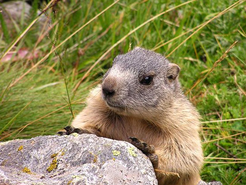
Several animals typical of the Alps have found on Orobie their habitat.
You can sight roe deer, chamois, wild goats: the latter have been recently reintroduced.
History and Traditions
There are several evidences witnessing the importance of these
mountains in the past, both for agricultural, sylvicultural, and
breeding activities and for trade.