


Il Cammino degli Astronomi di Brera
Reconstruction of the survey of the geodetic base of Somma for the Topographical Map of Milanese and Mantovano areas according to the more exact Geographical and Astronomical Observations (May - August 1788)
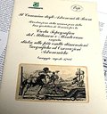
This project was born from the discovery of an ancient geographical map of the territory of Lombardy. Despite the lack of parts of the territory, a careful research activity has enabled its recognition as one of the few copies of the rare "Carta del Milanese e Mantovano", based on the surveys carried out - on behalf of the Austrian Government of that time - by the Astronomers of the Brera Observatory. The reconstruction of the long history of this map, the first map based on scientific surveys, has brought us back to the territory where the survey was carried out, today mainly covered by Malpensa airport. And here, in the moorland, we have found the traces of the historical deed of the 18th century Astronomers who, like real pioneers, wrote an important scientific page of the Enlightenment of Lombardy.
This project was born from the discovery of an ancient geographical map of the territory of Lombardy. Despite the lack of parts of the territory, a careful research activity has enabled its recognition as one of the few copies of the rare "Carta del Milanese e Mantovano", based on the surveys carried out - on behalf of the Austrian Government of that time - by the Astronomers of the Brera Observatory. The reconstruction of the long history of this map, the first map based on scientific surveys, has brought us back to the territory where the survey was carried out, today mainly covered by Malpensa airport. And here, in the moorland, we have found the traces of the historical deed of the 18th century Astronomers who, like real pioneers, wrote an important scientific page of the Enlightenment of Lombardy.
- Edited by: egambiente, Associazione Culturale Casimiro Teja
- Publisher: Consorzio Parco Lombardo Valle del Ticino
- Size: 17.3x24.5cm
- Price: free
Il Cammino degli Astronomi di Brera


© 2024 - Parco Lombardo della Valle del Ticino