From the Fuentes Trivio to the Mouth of the Adda
- Trail Conditions: On foot
- Interest: Flora, Wildlife, Bird Watching, Hystory
- Duration: 3 hour/s
- Recommended Period: from January to May, from November to December
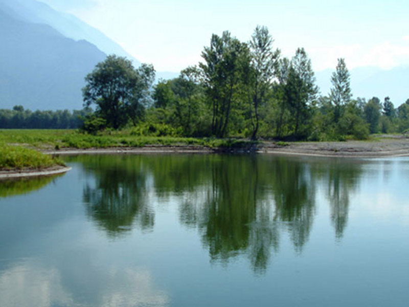
This itinerary winds along a dirt road that leads to the south-eastern part of the Reserve and can also be covered by bicycle. Once you reach the Trivio di Fuentes, near the Adda Bridge, follow the signs for Pian di Spagna and you can leave the car just beyond the level crossing. You then follow the straight road that runs along the north bank of the river and follow it up to the mouth.
You can observe the small vertebrates and the myriad of invertebrates that populate this narrow band between the river and the cultivated lands. At the edges of some ponds that line the road you can watch the evolutions of dragonflies and observe the kingfisher and the gray heron intent on fishing. The waters of the Borgofrancone canal in summer are entirely covered with water lilies and nannufari and are home to various animal species such as moorhens, coots and grebes.
The first part of the route is very suggestive and passes through a thicket of willows and poplars. Once you reach the mouth of the Adda you can observe the beaches and reed beds.
The Fuentes crossroads constitutes an important crossroads between Valchiavenna, Valtellina and Alto Lario and its name echoes the documented presence of the Spaniards. Evidence of their presence are the ruins of the Fuentes fort, located on the top of the last mountain of Colico . It owes its construction to Pedro Enriquez de Acevedo Count of Fuentes, governor of the state of Milan on behalf of the Spanish crown. It dates back to the early 1600s, when there was the danger of possible attacks by the French. The decision to build the fort did not please the Grisons, allies of the French, who tried in vain to prevent its construction. In 1606 the defense was completed and was preparing to host the first garrisons. Between occupations, reconquests and the spread of malaria which affected the soldiers, in 1796 the fort was destroyed at the hands of the Napoleonic forces.
During the First World War two gun batteries were positioned on the ruins of the old military structure. Since then the fort remained in the hands of the Fiocchi family from Lecco until 1998, when it was purchased by the province of Como which prevented its degradation with a series of restoration interventions. Today the remains of the ancient parade ground where the barracks, the mill and the church dedicated to Santa Barbara were located are still visible.
In addition to the Fort of Fuentes, two fortresses were built: one above Sorico and the other, the Fortino d'Adda, facing Valchiavenna. It was connected to other outposts, such as the Fontanedo tower, the Curcio tower and two tower houses located near the Fort.
- Route starting point: take the SS. 36 near the bridge over the Adda river, the carriage road that descends along the river for about 1.2 km, continuing along the route that leads to the mouth of the Adda.
- Duration of the route: approximately 3 hours.
- Best period: November - May