


Rigoso and Aneta Paths - Path towards Aneta (Green itinerary)
- Trail Conditions: On foot
- Interest: Panorama
- Duration: 1 hour/s 15 minutes
- Difficulty Level: tourist, very easy
- Length: 1.2 km
- Difference in height: about 120 m (uphill and downhill)
Presence of water: YES - town square of Rigoso (in front of the Church) and in the hamlet of Aneta.
This easy route connects the beautiful hamlet of Aneta with a splendid panoramic view of the Enza valley, from Succiso Alp to Ventasso Mount and beyond.
Further information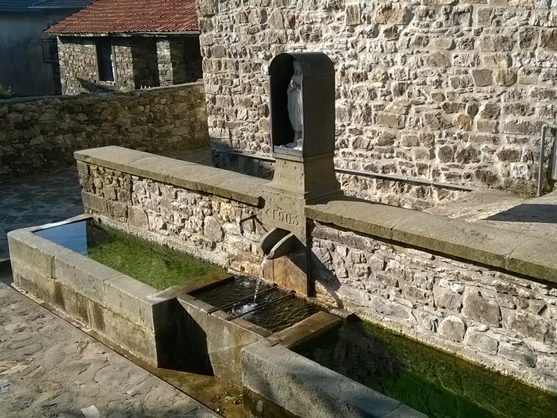
Fountain of Aneta
 Download KMZ
Books and Guides
Price: 12.00 €
Item Available at Emporio dei Parchi
Price: 12.00 €
Item Available at Emporio dei Parchi

Protected Area(1.472,00 ha)

Lay-out of the itinerary

Departure

Arrival

Park Authority Offices (5)

Visitor Centers (4)

Where to Sleep* (2)

Where to Eat* (1)

Mountain huts/bivouacs* (4)

Municipalities (4)

Points of Interest (2)

Photos (10)

Videos (1)

EV charge ≥100kW (286)

Airports (1)

Station (1)

Bus Stops (3)

Highway exits (4)
*: only Operators with Accommodation Page


© 2024 - Ente di gestione per i Parchi e la Biodiversità - Emilia Occidentale