Protected Area
Identity Card
- Land Surface Area: 1'472.00 ha
- Buffer zone: 26'277.18 ha
- Regions: Emilia Romagna
- Provinces: Parma
- Municipalities: Corniglio, Monchio delle Corti, Neviano degli Arduini, Tizzano Val Parma
- Establishment Measures: LR 46 27/04/1995 - L.R. 22 del 30/11/2009 - L.R. 24 del 23/12/2011 e L.R. 13 del 30/07/2019
- PA Official List: EUAP0959
![]() Statute: Approved with the Council Resolution no. 1 of 28.02.2007 (PDF, Italian text - 93Kb)
Statute: Approved with the Council Resolution no. 1 of 28.02.2007 (PDF, Italian text - 93Kb)
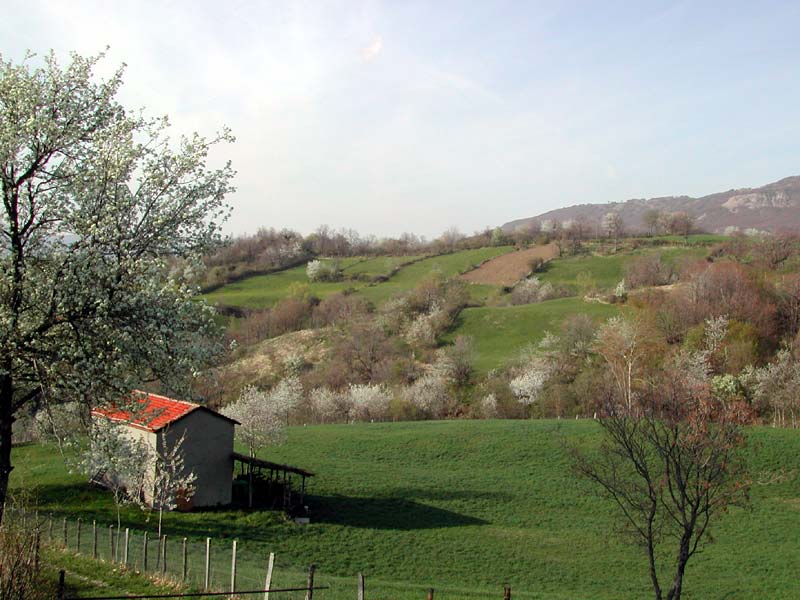
Valli del Cedra e del Parma Regional Park, best known as Cento Laghi Park, extends itself in a section of the eastern Apennines of the area of Parma, at the border between the Provinces of Reggio-Emilia and Massa-Carrara. Since it develops at various altitudes (from 400 to 1,650m asl), it guarantees a great variety of environments and a considerable biodiversity level. A still intact environment, where for centuries nature has lived together with human activities to give life to excellent agri-foodstuffs known all over the world like Parmigiano-Reggiano PDO and Parma Ham PDO. A cosy "middle-earth" between the plain of Parma and the summits of Appennino Tosco-Emiliano National Park.
The Environment
Born in 1995 as Parco di Crinale dell'alta val Parma e Cedra (Ridge Park of Upper Parma and Cedra Valley), after the establishment (2001) and the enlargement (2010) of Appennino Tosco-Emiliano National Park, this Protected Area has set up again its own boundaries and changed its own "mission": as a matter of fact, now it aims not only at safeguarding the wonderful high-mountain environments, rich in nature and almost entirely deserted, but also at enhancing the middle-mountain rural landscape, still well-preserved and rich in biodiversity, agriculture, local products, culture, and tourism. A territory where people live and work!
The recent redefinition of the perimeter has increased the surface area of the Park that, after entrusting the safeguard of the ridge areas to the nearby National Park, has transformed itself into a more varied reality mainly developing towards the valley. The Park areas of Upper Cedra Valley (Monchio delle Corti), whose slopes have been shaped by the Quaternary glaciations, the beech tree woodlands and the high-mountain grasslands, have been joined by the area of Mt. Caio (1,584m), developing along the slope between Cedra and Parma Upper Valleys, of floristic interest for the presence of various thermophilous plants including Cirsium bertolonii (an endemic species of the northern Apennines). Oak and chestnut tree woodlands interrupted only by meadows and meadow-pastures, historical villages, and small town centers suspended in time characterize the wild Val Bratica, the homeland of Poeta Attilio Bertolucci, dominated by the wonderful "natural balcony" of Mt. Navert (1,657m asl). The wildlife includes particularly rare and protected species like the Wolf of the Apennines and the Golden Eagle.
At lower altitudes, the adjacent area which has tripled since 1995 includes large sections of agricultural landscape linked to the production of Parmigiano-Reggiano cheese and Parma Ham, where permanent pastures are surrounded by small woodlands, hedges, and fruit tree rows.


History and Local Traditions
The Feuds of Corniglio and Tizzano and the Corti di Monchio
The Valleys of Torrents Parma and Cedra, for their eccentric position with respect to the town of Parma, have been subject for centuries to feudal institutions characterized by a strong independence.
The feud of Corniglio was transformed into a county by Rossi, the lords of Parma, who owned it until the early 17th century (when it became part of the ducal estates of Farnese). Monchio delle Corti, instead, although linked to the bishops of Parma, was for centuries the protagonist of an original form of self-government extended to the upper Cedra valley and to limited sections of Bratica and Enza valleys. The government of the 14 "corti" (Monchio, Casarola, Ceda, Grammatica, Lugagnano, Nirone, Pianadetto, Riana, Rigoso, Rimagna, Trefiumi, Valcieca, Valditacca, Vecciatica), which survived as an institution until the Napoleonic period, was entrusted to a podestà appointed by the bishop. The seat of this government was first in Rigoso and then in Monchio.
Of ancient origins, like Corniglio and Monchio, also the territory of Tizzano val Parma, a fertile and easily accessible area, housed a feud which was disputed among various families: from Da Correggio, to Fieschi, to Pallavicino, to Terzi, to Sforza, to Farnese, and to Venturi, the last lords of Tizzano and Ballone. Its illustrious past is witnessed by the charming rests of the ancient castle dominating the town, whose presence was already mentioned in the 10th century.
Tizzano also represented a strategic point as far as the ecclesiastical territorial organization is concerned: situated along the ancient Via di Linari, one of the arteries of Via Francigena, it housed a "Pievato", whose ancient presence is demonstrated by the Country Church of St Peter dating back to the 11th century, in a panoramic position.