


Giroparco
- Trail Conditions: On foot
- Interest: Flora, Geology, Panorama, Hystory
- Departure: Lago del Telessio (860m)
- Arrival: Colle Larissa (2,683m)
- Length: 50 km
- Difference in height: 6,000m
- Accomodation structures: Rifugio Pontese
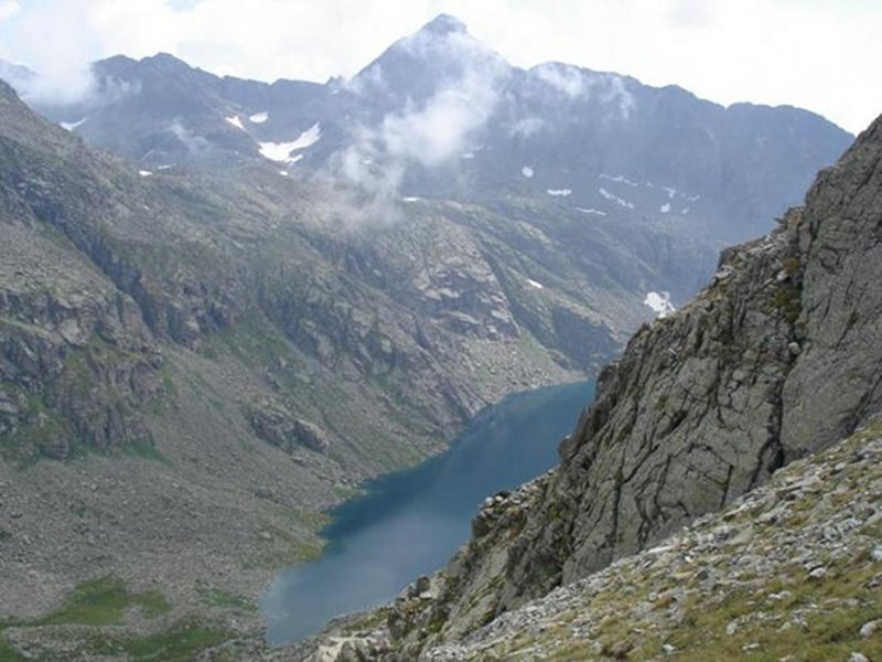
The itinerary is situated between the left middle side of the Orco Valley and the head of the Soana valley, starting from the Telessio lake to reach the Hill Larissa, with a total of 6 legs and one alternative route. Its total length amounts to over 50 km with a total difference in height of 6,000 m. The itinerary develops in an alpine environment, with a minimum altitude of 860 m near Ronco Canavese, and a maximum altitude of 2,683 m by the Bocchetto di Valsoera, and with the highest accommodation point, the Pocchiola Meneghello mountain hut, situated at 2,450 m. Most of the paths are classified with a hiking difficulty level (E), some stretches as touristic paths (T) and some high-altitude trails as difficult-hiking paths (EE).
Further informationDuration: 3 h 50 m
Tappa variante 1A: Chiapili di Sopra - path fork near A. Comba
Duration: 2 h 30 m
2 tappa: Bivacco Giraudo - Noasca
Duration: 3 h 30 m
3 tappa: Noasca - San Lorenzo (Piantonetto)
Duration: 5 h 10 m
Duration: 7 h 15 m
5 tappa: Talosio (Ribordone) - Ronco Canavese
Duration: 4 h 35 m
Duration: 5 h 45 m
Duration: 3 h 45 m
Duration: 4 h 45 m


© 2024 - Ente Parco Nazionale Gran Paradiso