


Protected Area
Identity Card
- Land Surface Area: 6'122.00 ha
- Lower altitude (m): 50
- Higher altitude (m): 515
- Protected flora: 10 species (Italian text)
- Protected wildlife: 103 species (Italian text)
- Habitats: 21 types (Italian text)
- Regions: Emilia Romagna
- Provinces: Bologna, Ravenna
- Municipalities: Borgo Tossignano, Brisighella, Casalfiumanese, Casola Valsenio, Fontanelice, Imola, Riolo Terme
- Establishment Measures: L.R. 21/02/2005
- PA Official List: EUAP0696
- Park Authority: Ente di gestione per i Parchi e la Biodiversità - Romagna
Il Parco
Vena del Gesso Romagnola Regional Park was established by Regional Law No 10 on February 21st, 2005.
The overall area covers 6,063 hectares, of which 2,041 hectares of park and 4,022 hectares of contiguous area. The Park is composed of: an A zone (strict reserve), 52 hectares; a B zone (general reserve), 749 hectares; a C zone (environmental reserve), 1,240 hectares.
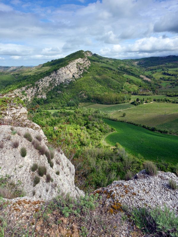
In Romagna's western Apennines, the gypsum vein (Vena del Gesso Romagnola) intersects the valleys of Santerno, Senio, Sintria and Lamone, about 10 kilometres before they join the plain. It is a ridge of calcium sulphate at various stages of crystallisation, imposingly layered, outcropping for about 20 kilometres and with a maximum width of one km, across the municipalities of Casalfumanese, Borgo Tossignano and Fontanelice in the province of Bologna, and of Casola Valsenio, RioloTerme and Brisighella in the province of Ravenna.
Because of its size and composition, of its extraordinarily varied morphology, and of the typical flora and fauna it harbours, the gypsum-sulphate ridge has deeply affected the surrounding landscape, favourably influencing the four valleys' microclimate, and also leaving its mark in history and in people's lives.
It is a natural and historical heritage, that surprises and fascinates hikers walking on the Park's trails. Some of them run across the spurs, in the green and shaded north-facing slope or in the bright dryness of the southern ones, which used to be called "moonstones" for the way they reflected the moon's light. Other trails wind along the ridge, and at every turn they offer evocative glimpses of the crystallisation of gypsum or of ponors, karst springs and caves that bear the signs of ancient human presence, rare botanical species, and wild animals rapidly running away.
The life and work of man have left their traces, too: dwellings, ruins of religious or military buildings, or ancient gypsum caves. But the most rewarding hike is right along the watershed: a trail that fills the eye and the soul with the Vein's abundance and the view embracing the mountain and the valley.
On one side, the green-blue ridges follow one another as far as the eye can reach;
On the other, beyond the dry spiderweb of the gullies, the plain is white with houses, villages and towns, and bordered by the sea, which looks from here like a long, blue line.
Geology
To understand how a rock body formed, it is necessary to observe above all its shape and geometry: observing for instance if it is stratified, and in our case it is rather evident it is. Then it is necessary to study the materials forming the strata, the period, and the environment where they deposited, and with which formations are in contact, as well as the whole geological context welcoming them.

Flora
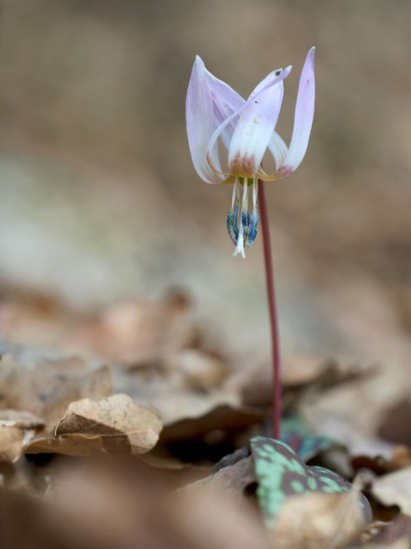
Vena dei Gesso houses an extremely rich and interesting flora: an extraordinary variety of environments welcomes almost 2,000 vegetable taxa (species, subspecies, and varieties), catalogued by Zangheri.
Despite the environment being harsh and inhospitable, the vegetation continuously changes the landscape, with unusual and extraordinary shapes and colors. There are wonderful violet orchids and white and yellow rock roses in spring, rare orange lilies in the meadows in June, rosy carnations in autumn, to mention just a few.
Fauna
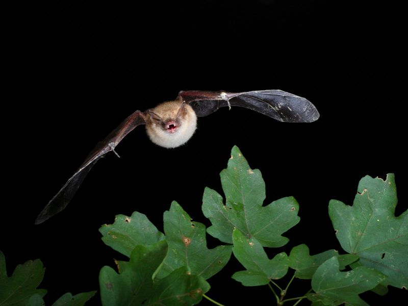
As far as vertebrates are concerned, there are 242 species, including 52 mammal species, 138 bird species, 12 reptile species, 12 amphibian species, and 28 fish species.

Historical landscape
The connection between man and the gypsum vein is ancient and manifold. In the proto-historic period the caves of Tanaccia and Re Tiberio were used as shelter and, in their deepest parts, as a cult place of the god of water, whose pounding could be heard in the pits. During the Middle Ages religious and military settlements were built on the Vein, in Brisighella, Rontana, Monte Mauro, Sassatello, Rocchetta, Tossignano, Gesso.
They were often built using gypsum blocks, and the same is true for rural houses in Crivellari, Borgo Rivola, Gesso, and for the towns of Brisighella and Tossignano. The use of fired gypsum is more ancient and widespread, as mentioned in a chronicle of Brisighella from the year 1594: "mountains of gypsum which, fired and ground, is excellent for building houses"; for over five centuries, gypsum workers toiled in the quarries of Tossignano, Brisighella and Borgo Rivola.
Generations of farmers also lived around the Vein, using the woods and farming the land above the cliffs; and thus creating a pleasantly varied landscape, with copses, grazing land, vineyards, fruit orchards and olive groves. The Vein sheltered the area from the northern winds and created a favourable microclimate, as local peasants had well understood: in the Middle Ages they started farming the area and planting chestnut woods like the one in Campiuno.


