

Orvinio – Le Pratarelle - Cima Casarene
A very charming itinerary
- Trail Conditions: On foot
- Interest: Flora, Wildlife, Archeology, Hystory
- Departure: Orvinio
- Arrival: Cima Casarene
- Duration: 4 hour/s 30 minutes
- Difficulty Level: E - Hiking (level)
- Difference in height: 300m
- Minimum Altitude: 870m
- Maximum Altitude: 1,191m
The itinerary develops in the Sabina area, at the northernmost edge and on the ridge representing the watershed between the basins of river Turano in the east and the complex system of ditches tributaries of Fosso Corese, belonging to the basin of the river Tiber. A very charming itinerary for the landscapes and for the interesting history of the places, as well as for the particular loneliness of an area not visited by hikers.
Further information
Landscape of Lucretili
 Download KMZ
Books and Guides
Price: free

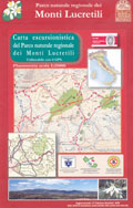
Protected Area(18.204,00 ha)

Lay-out of the itinerary

Departure

Arrival

Park Authority Offices (2)

Visitor Centers (2)

Municipalities (13)

Photos (15)

Videos (11)

EV charge ≥100kW (286)


© 2024 - Ente Parco Naturale Regionale dei Monti Lucretili