Localities
The Park's villages
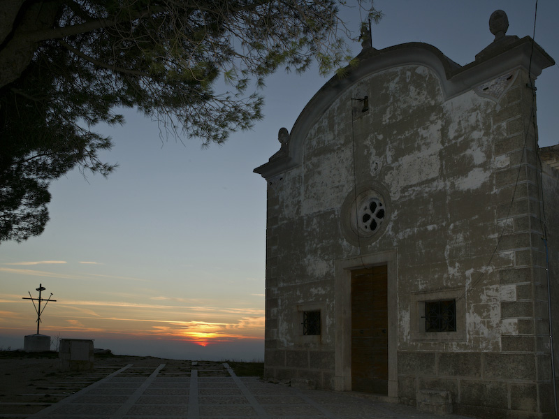
"National Park" does not only mean "nature": the Abruzzi, Lazio and Molise National Park is also made of small villages which still preserve their own identity coming from the many historical facts and traditional lifestyles.
In the Park there are twenty-four municipalities, each of them deserves a short description to make you get ready to visit them.
Municipalities in Abruzzo
Gioia dei Marsi and Lecce nei Marsi
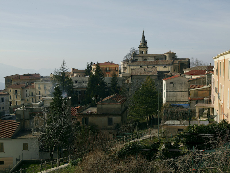
Within the Park, these two municipalities stand out for the exceptional abundance of traces left by the Marsi civilization. Such traces are however hard to perceive for a normal observer, who is more likely to be hit by the uniformity of the settlements and of modern residential architecture, which resulted from the 1915 earthquake destruction. The remains of ancient settlements, abandoned after the earthquake, can be observed around modern residential areas, often in solitary and very evocative places.
Municipalities in Abruzzo's minor valleys
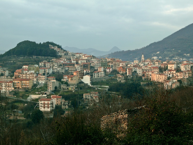
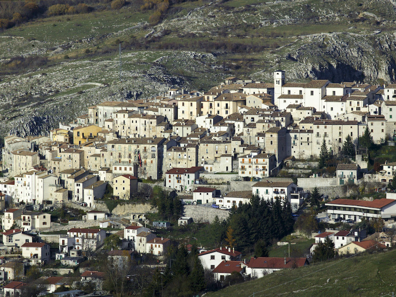
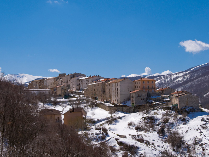
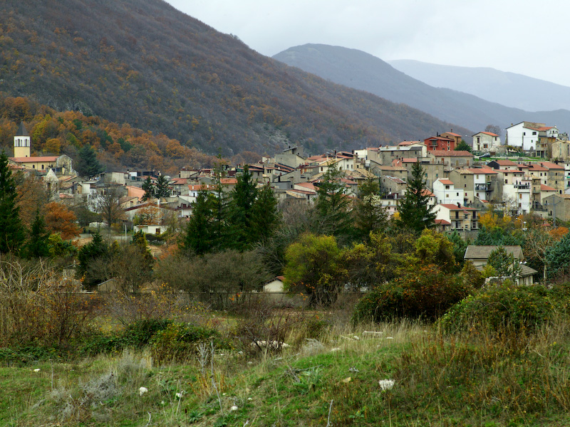
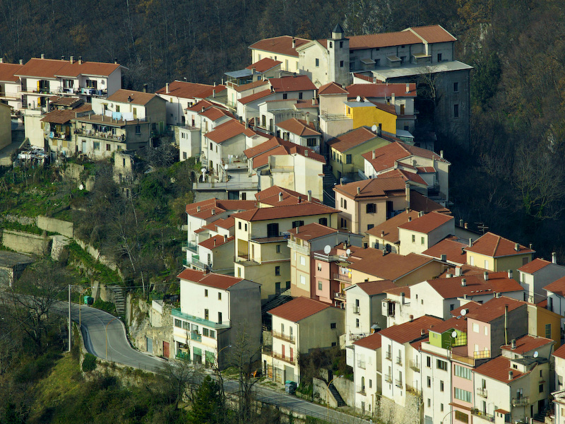
They are the municipalities of Villavallelonga, in the basin of Fossato di Rosa; Ortona dei Marsi and Bisegna in the Giovenco Valley; Scanno in the Tasso Valley. Their settlement model characterizes these villages: they were compactly built on high grounds, in strategic positions to access resources both on the mountain and on the valley floor. Thanks to their position and type of settlement, the old towns' medieval features have been preserved, with narrow and winding roads and vertically developed buildings.
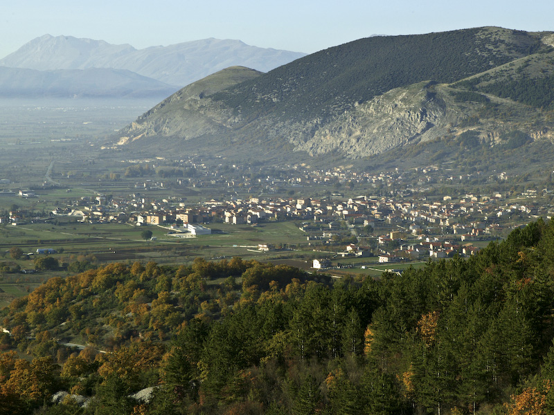
Municipalities in the upper Sangro basin
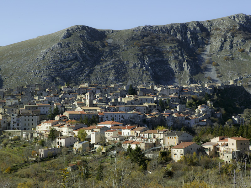
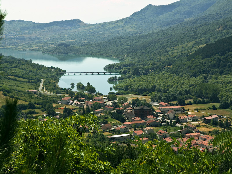
Whereas Pescasseroli and Barrea are positioned in order to control the two ends of the valley, the towns of Opi, on a rocky spur, and Civitella Alfedena, on a wide terrace, are located on higher spots in the middle of the valley, in suitable positions to defend it.
Villetta Barrea is situated in a less striking position, which could however be justified by the need to control the valley of the Profulo stream, almost perfectly aligned with the Tasso-Sagittario valley.
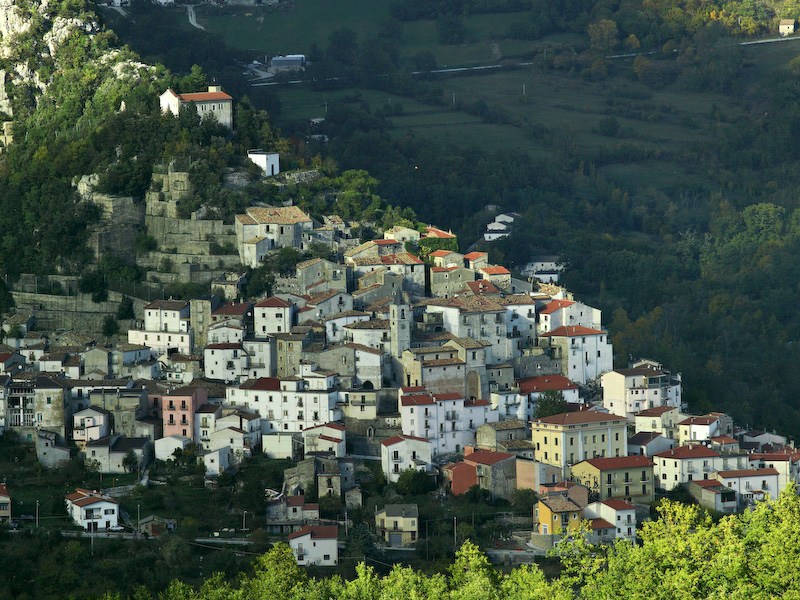
Nonetheless, defence was maybe not the main ground for the foundation of these towns. Another plausible theory puts practical and economic reasons at their origin: areas suitable for cultivation are located on the valley floor, which is seldom wide; this valuable ground could not be took up by buildings, which could be placed instead on a higher position, still allowing inhabitants to look after their cultivations below. Indeed, the position undeniably suited the needs of these towns as, throughout the centuries, no twin towns rose up in lower positions. The only relocation case occurred to Pescasseroli, whose inhabitants abandoned the first settlement around the castle, probably in the XIV century, and moved to the lower village of Peschio (Bevilacqua 1952, 64). The local medieval fortifications do not contradict this theory, since they were created as an adaptation to specific, pre-existing contingencies.
In the valley section reaching out to the Castel di Sangro basin, outside the Park area, the town of Scontrone is located in the same type of position as Opi, on a spur above the river, whereas the modern Alfedena is a town on the valley floor along the Rio Torto stream, near its confluence with the Sangro River.
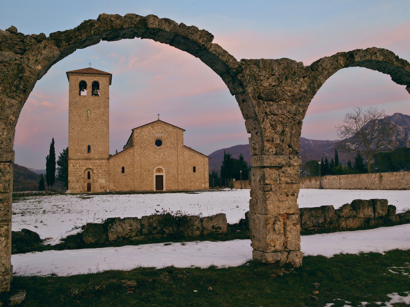
The historical capital of the Abruzzo, Lazio e Molise National Park
Municipalities in Molise
The current elevation profile of local residential areas resulted on one hand from the monastic colonization by the Abbey of San Vincenzo, and on the other hand from people's habit of settling on elevated grounds, such as hills and borders of terraces or karst hollows, which were more easily defendable. Then, in the last two centuries a new settlement model overlapped with the traditional one, and scattered rural dwellings and hamlets appeared as a consequence of several factors: better safety conditions, the splitting up of former large feudal estates, and the concession of rights on plots of land by feudal lords to peasants. This new model spread itself actively until the1950s, especially in municipalities encompassing vast expanses of cultivable land. Large numbers of people thus abandoned traditional settlements, which had arisen and grown thanks to the feudal model, even when topographical conditions were very bad. At that time such towns looked therefore neglected and run-down, with numerous empty or ruined houses.
In the following years, until 1975 - 1980, in the upper Volturno Valley the generalized crisis of Italian mountains added itself to the crisis of southern Italy, leading to massive migratory flows and desertion of many isolated settlements. Nonetheless, scattered settlements are an important territorial feature still today in the municipalities of Filignano and Scapoli.
The following and very recent phase is remigration: the number of inhabitants and houses in residential areas has partially recovered, unfortunately in questionable ways; but this phase is also marked by the immediate and long-term consequences of the 1984 earthquake, which had its epicentre in Val Comino. Many houses were seriously damaged and never repaired, in contrast with what happened in the other Park municipalities both in Latium and Abruzzo. As an example, suffice it to say that the emergency wooden huts in San Vincenzo al Volturno are still inhabited.
As far as exposure is concerned, most towns are oriented to the south (typical examples are Pizzone, Castelnuovo and Rocchetta) or at least protected from northern winds by the mountains surrounding the Volturno Valley to the northwest and northeast. Scapoli and Castel San Vincenzo are prime examples in this respect.
Municipalities in Latium
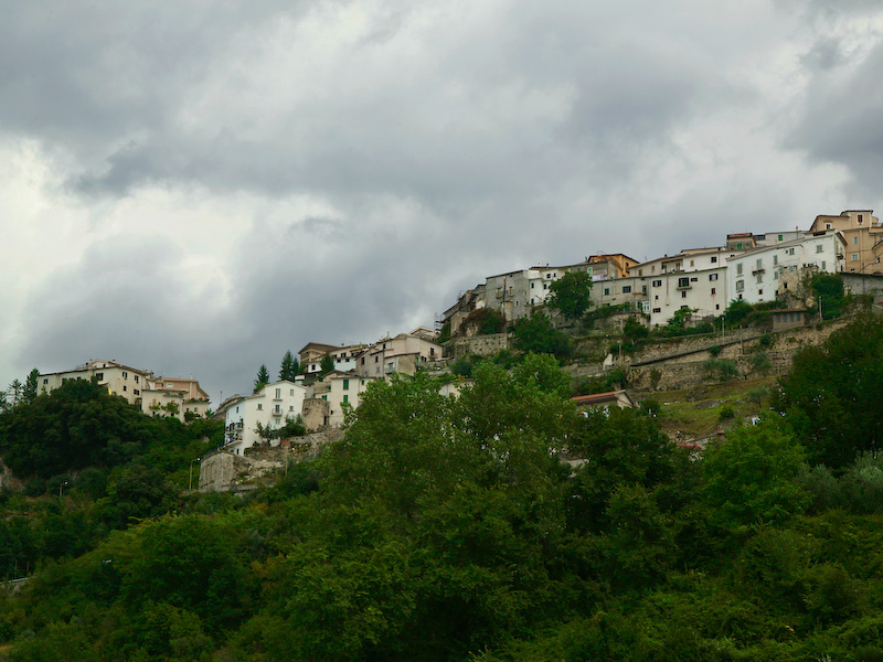
Within the Park territory, municipalities in Latium stand out for their sharp difference in elevation between highest and lowest points: climate, vegetation and cultivations vary accordingly. Such difference is instead not so marked as far as the inhabited area is concerned: according to the 1991 population census, all towns and villages are located within an area, which has its lowest point in Mole di Vito (390 metres asl) and the highest one in Fontitune (952 metres asl). Both localities are included in the municipality of Picinisco, which in the 1950s encompassed other residential areas higher than 900 metres asl (Rocca Capotunno and Rocca degli Alberi), but they are today uninhabited. Another typical feature of these municipalities is the high percentage of people living in scattered houses and hamlets, which explains why small towns are seemingly over-endowed with services.
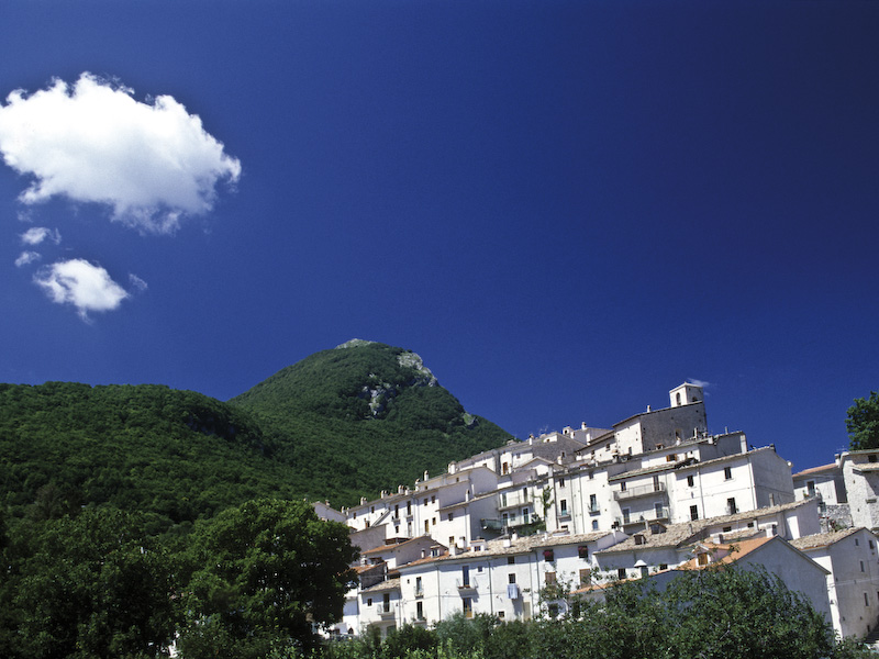
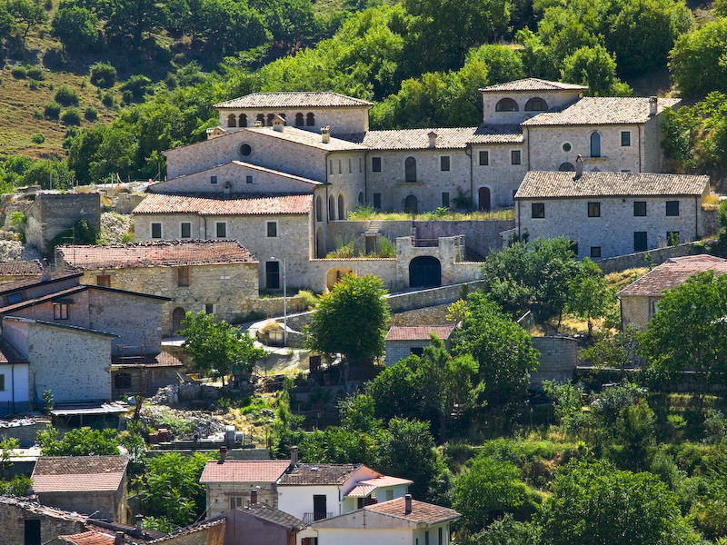
All the residential areas are situated higher than 400 metres asl, on hill tops or other overlooking positions on valley borders; they are all located near cultivable areas and water springs, mostly on limestone soil and facing south. Topographical positions are on the contrary diverse: villages can be situated on slopes (Alvito), on spurs (Picinisco), on ridges (Le Caselle in the municipality of Settefrati), in mixed-type locations between a spur and a fan (San Donato Val di Comino) or between a peak and a saddle.
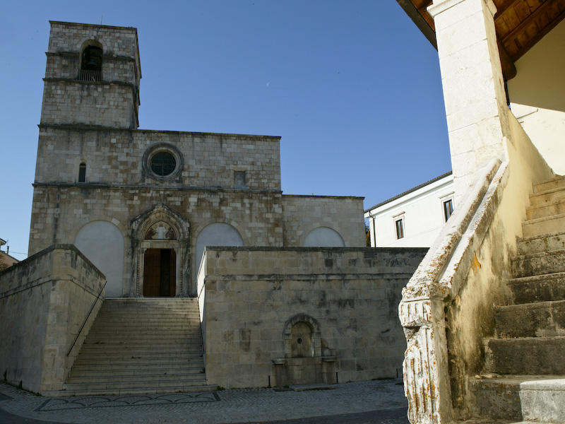
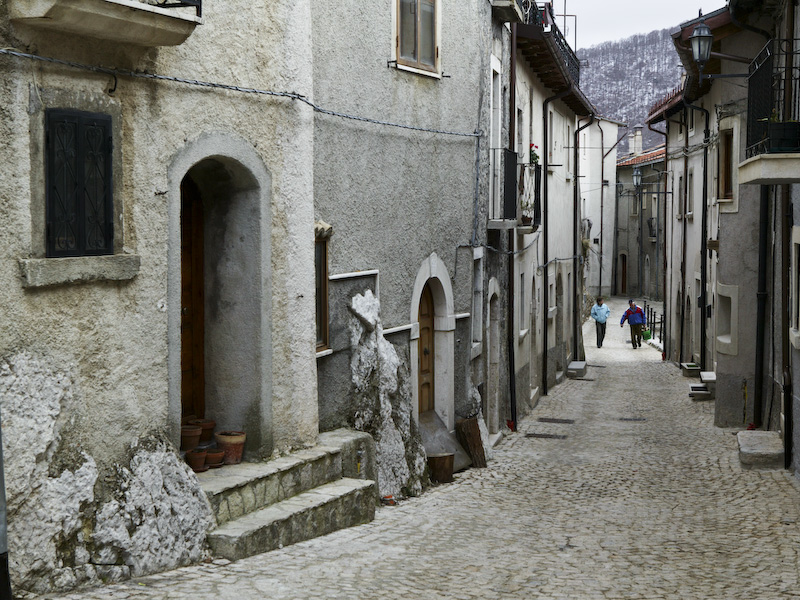
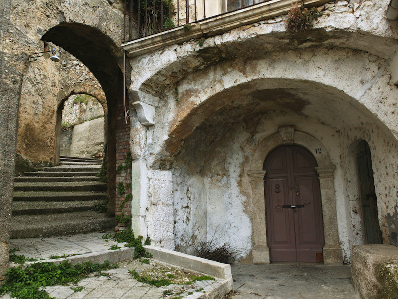
Almost all the villages feature the ruins of an ancient castle in their oldest part (Alvito is a prime example in this respect). Street patterns are irregular in the old towns: narrow and winding cobblestone alleys converge towards the church square; streets run parallel to contour lines and are often connected by steep stairs.
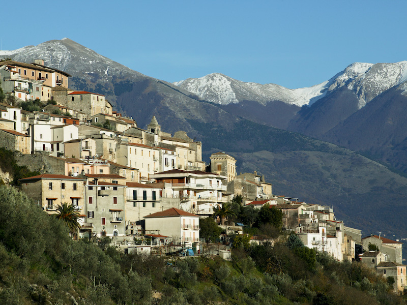
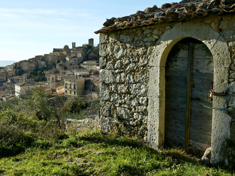
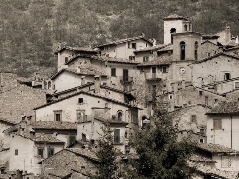
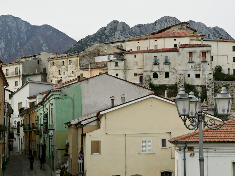
A picturesque medieval village on the carbonate rock cliffs of Monte Pizzuto