


Alta Via dei Parchi - The 8 hiking maps box set, scale 1:50000
Waterproof and tear resistant map
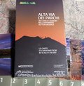
The Alta Via dei Parchi starts in Berceto, near the Cisa Pass in the Province of Parma, and it reaches the Verna cliff first, which overlooks the Casentino valley, and then the hermitage on Mount Carpegna, crossing two national parks, five regional parks and one interregional park: a 500-km-long itinerary reaching 27 accommodation points along the Apennines through Emilia-Romagna, Tuscany and The Marches. To complete the guides the 1:50,000 scale hiking maps covering the whole itinerary and the area of the involved Parks have been realized. In order to produce these maps the cartographic Archive of the Emilia-Romagna Region created a new specific and up-to-date cartographic basis. They are all printed on waterproof, tear resistant and 100% completely recyclable Polyart paper.
The Alta Via dei Parchi starts in Berceto, near the Cisa Pass in the Province of Parma, and it reaches the Verna cliff first, which overlooks the Casentino valley, and then the hermitage on Mount Carpegna, crossing two national parks, five regional parks and one interregional park: a 500-km-long itinerary reaching 27 accommodation points along the Apennines through Emilia-Romagna, Tuscany and The Marches. To complete the guides the 1:50,000 scale hiking maps covering the whole itinerary and the area of the involved Parks have been realized. In order to produce these maps the cartographic Archive of the Emilia-Romagna Region created a new specific and up-to-date cartographic basis. They are all printed on waterproof, tear resistant and 100% completely recyclable Polyart paper.
- Publisher: Ediciclo
- ISBN: 9788865490686
- Scale: 1:50000
- Price: 28.00 €
Item temporarily sold out at Emporio dei Parchi
Item temporarily sold out at Emporio dei Parchi
Alta Via dei Parchi - The 8 hiking maps box set, scale 1:50000


© 2024 - Ente Parco Nazionale Appennino Tosco-Emiliano