


Mt. Ventasso
- Trail Conditions: On foot
- Interest: Flora, Geology, Panorama
- Departure: Rifugio Pratizzano (1,203m)
- Arrival: Rifugio Pratizzano (1,203m)
- Duration: 4 hour/s
- Difficulty Level: E - Hiking (level)
- Difference in height: 650m
- Maximum Altitude: 1,727m
- Recommended Period: from June to October
- Localities Crossed: Pratizzano - Lago Calamone - S. Maria Maddalena - M. Ventasso - Pratizzano
From the gentle Pratizzano pass to the isolated Mt. Ventasso, one of the most panoramic and characteristic mountains of the Park slope in Emilia. It stands out like a pyramid between the valleys of Secchia and Enza, far from the ridge, but with a severe aspect and glacial morphologies. Calamone Lake, or Ventasso Lake, has glacial origins like the peat bogs surrounding it, while the imposing sandstones of the summit clash with the surrounding clayey and calcareous formations covered with beech woods and clearings used as pastures.
Further information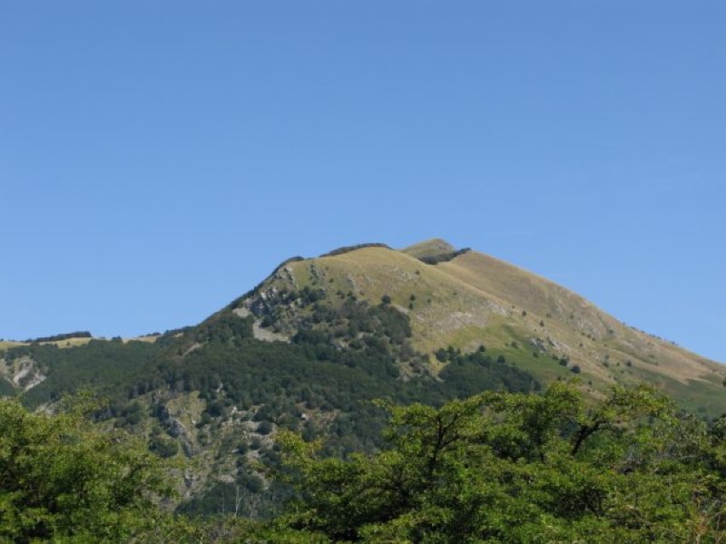
Mt. Ventasso from Vallisnera
Books and Guides
Price: 12.00 €
Price: 18.00 €


© 2024 - Ente Parco Nazionale Appennino Tosco-Emiliano