


Mt. Cisa and Mt. Prampa
- Trail Conditions: On foot
- Interest: Geology, Panorama
- Departure: Rifugio Monteorsaro (1,278m)
- Arrival: Monteorsaro
- Duration: 4 hour/s 30 minutes
- Difficulty Level: E+ - Hiking (level)+
- Difference in height: 600m - maximum 1,701m
- Recommended Period: from May to October
- Localities Crossed: Monteorsaro - M. Cisa - M. Prampa - Monteorsaro
Mt. Cisa and Mt. Prampa can be seen from the whole Val Secchia, since they stand out from the main ridges and seem to protect from the north wind the village of Monteorsaro, the highest historical settlement of the valley. Therefore, great panoramas and great geological and landscape interest, along trails crossing ancient pastures that have been contented for centuries.
Further information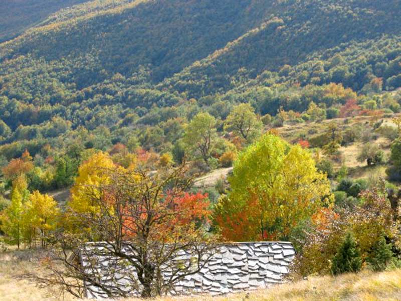
Tetti di Monteorsaro
Books and Guides
Price: 12.00 €
Price: 18.00 €


© 2024 - Ente Parco Nazionale Appennino Tosco-Emiliano