


Mt. Sillara
- Trail Conditions: On foot
- Interest: Geology, Panorama
- Departure: Prato Spilla (1,353m)
- Arrival: Prato Spilla
- Duration: 6 hour/s 30 minutes
- Difficulty Level: E - Hiking (level)
- Difference in height: 750m - maximum 1,861m
- Recommended Period: from June to October
- Localities Crossed: Prato Spilla - L. Verde - Laghi di Compione - Laghi Sillara - M. Sillara - Passo di Compione - Lago Martini - Prato Spilla
The itinerary, probably the most complete and panoramic itinerary of the ridge of the lakes, partly follows one of the busiest trails for the beauty of the lakes you touch with it: it offers great views in the mountains, following the high ridge of Val Cedra, with its 8 highest and most charming lakes, often immediately under the ridge.
Further information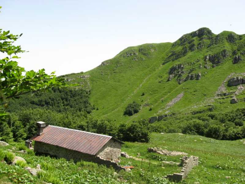
Capanna Cagnin
Books and Guides
Price: 12.00 €
Price: 18.00 €


© 2024 - Ente Parco Nazionale Appennino Tosco-Emiliano