


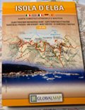
Isola d'Elba - Carta turistico-stradale e nautica 1:30.000
Tourist Road Map and Nautical Chart - Carte touristique et routière - Touristische Strassen- und Seekarte - Mapa turístico - de carreteras y nautique
In this map, the traditional information provided by a road map have been included in the detail of a topographical map: in this way, we have the ideal instrument to carry out tours to discover the territory by car, by bike, on foot or on horseback.The map includes all the trails and the whole tourist-cultural heritage that has been surveyed and included in the map using specific symbols.
- Publisher: LAC - Litografia Artistica Cartografica
- ISBN: 978-88-7914-371-4
- Size: 12x17.5cm (closed), 99x67cm (open)
- Scale: 1:30.000
- Price: 8.00 €
- Text language: ItalianoEnglishDeutschFrançaisEspañol
Isola d'Elba - Carta turistico-stradale e nautica 1:30.000


© 2024 - Ente Parco Nazionale Arcipelago Toscano