

Protected Area
Identity Card
- Antola Regional Nature Park:
- Land Surface Area: 4'811.77 ha
- Protected flora: 6 species (Italian text)
- Protected wildlife: 95 species (Italian text)
- Habitats: 12 types (Italian text)
- Regions: Liguria
- Provinces: Genova
- Municipalities: Busalla, Crocefieschi, Fascia, Gorreto, Montebruno, Montoggio, Propata, Ronco Scrivia, Rondanina, Savignone, Torriglia, Valbrevenna, Vobbia
- Establishment Measures: LR 12 22/02/1995
- PA Official List: EUAP0965
- Park Authority: Ente Parco dell'Antola
- Further managed Protected Areas:
- Zona Speciale di Conservazione Conglomerato di Vobbia
- Zona Speciale di Conservazione Lago Brugneto
- Zona Speciale di Conservazione Lago Marcotto - Roccabruna - Gifarco - Lago della Nave
- Zona Speciale di Conservazione Parco dell'Antola
- Zona Speciale di Conservazione Rio di Vallenzona
- Zona Speciale di Conservazione Rio Pentemina
- Zona Speciale di Conservazione Val Noci - Torrente Geirato - Alpesisa
- Regional Law no. 12 of 22/02/1995
- The Park Statute: published on BURL of 27/04/2011 no. 4 part III
- The Park Plan: approved with Decision of the Regional Council no. 42 of 03/08/2001
The Park Means...
Surface Area: protected area 4,837 ha, adjacent area 5,832 ha
Antola Park represents one of the most charming areas of
the Ligurian Apennines. The territory is characterized by hills and
mountains and borders in the north with Piedmont and in the east with
Emilia-Romagna. It can also be easily reached from the Province of
Pavia. It consists of two valleys (Scrivia and Trebbia Valleys) which are
very different from a geomorphological point of view: from rocky
formations like the Savignone conglomerate to the sweet hills of the
marly limestone of Antola.
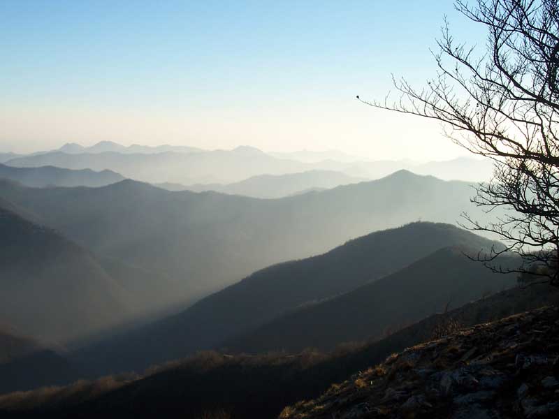
The protected area is characterized by a great
variety of environments: overhanging rocky slopes, woodlands, pastures,
clearings, watercourses and basins rich in water, valleys, and
panoramic summits. As a matter of fact, from the summit of Mt. Antola
you can enjoy the view of a great natural, historical, architectural,
and traditional heritage.
Antola valleys are also an ideal place to practice sports and other activities thanks to the thick network of hiking itineraries (270 km of paths, almost all signalled with F.I.E.): horse riding,
canoeing (kayak) along the watercourses of Trebbia and Scrivia Valleys, climbing and mountaineering, mountain-biking and cycling; paragliding and hang gliding (Mt.
Maggio), sport fishing, winter walks along the whole ridge of Antola, with cross-country skis or ski touring.
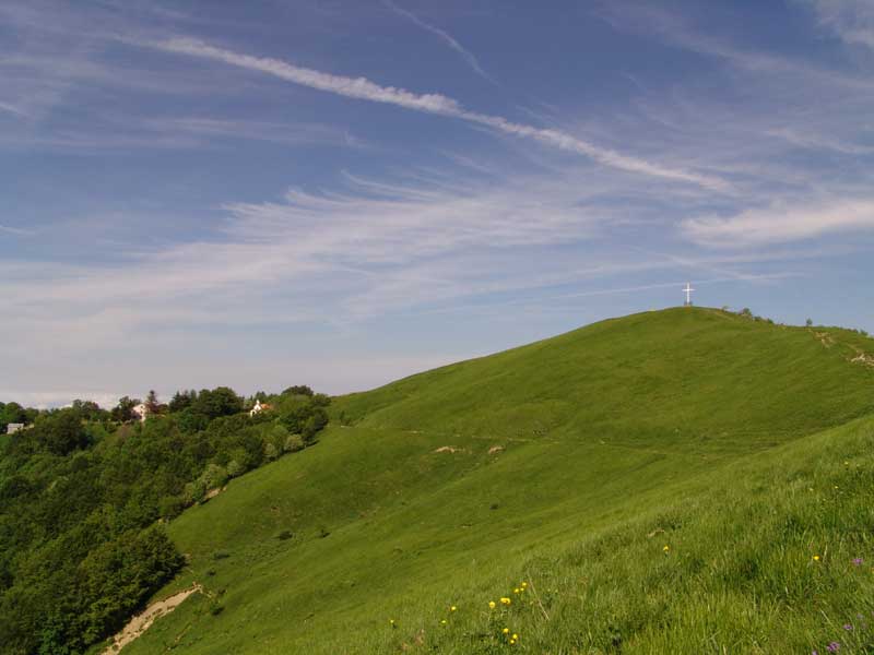
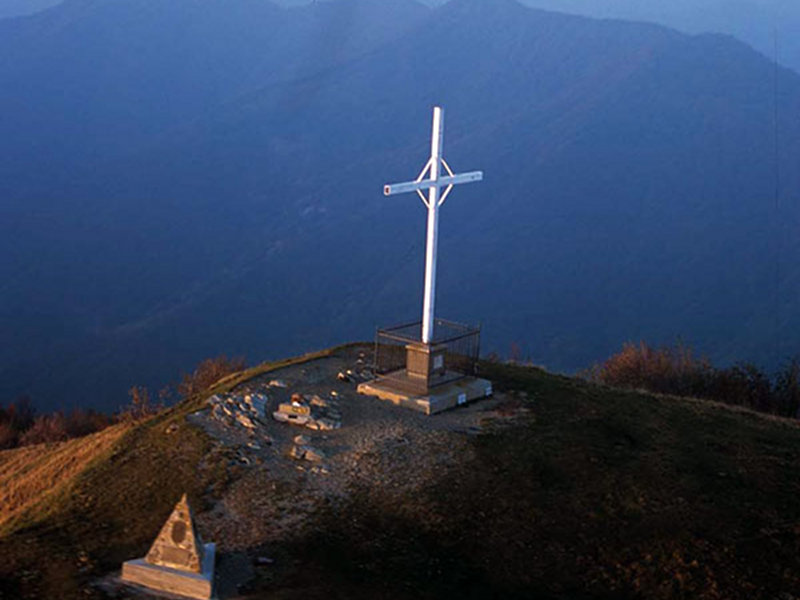
Mt. Antola
Mt. Antola is the highest peak in the Park (1,597m) and it is situated
on the ridge linking the upper Valle Scrivia with the upper Valle
Trebbia. It is known for its charming bloomings coloring its slopes. Besides the abundant narcissi in bloom, flowers that are rare today in Liguria, you can admire various species of orchids, gentians, lilies, buttercups, and columbines...
A traditional destination for hikes, Mt. Antola is a historical
crossroads which, through a network of paths and mule tracks, has
allowed the movement of local communities and their commercial and
cultural exchanges.
Next to the summit, where the new Park mountain hut will soon be
completed, you can enjoy a wonderful view which, if the weather is fine
and the sky is clear, goes from the Ligurian Sea to the massifs of the
north-western Alps (Monviso, Rosa, Bianco).
The Park Valleys
Val Vobbia
Following Val Vobbia, whose stream flows into the Scrivia in Isola del Cantone, you will be fascinated by the wild scenery offered by the canyon dug in the conglomerate rock. Between two natural puddingstone towers, Castello della Pietra was built in the year 1000: it represents one of the main attractions of the valley characterized by steep rocky slopes alternating with slopes covered by chestnut tree woods. The chestnut tree, which has been introduced in the area by the local population, has been one of the most exploited resources in these valleys until the half of this century. Its fruits were either eaten as fresh fruit, or grinded in the mills to produce flour after being dried in typical stone buildings (the so-called "seccherecchi"). The widespread use of the chestnut tree as firewood and as timber has led to the transformation of the high trunk chestnut tree woods into coppice woods. Despite this, it is possible to find woods with centuries-old chestnut trees both in Val Vobbia (for instance, by following the self-guided itinerary "Il Sentiero dei Castellani") and in other valleys of the Park.
Val Pentemina and Val Brevenna
Val Pentemina and Val Brevenna have a great historical importance given to the evident traces of the farming culture which they still preserve on their slopes. The presence of ancient rural villages (among which Pentema, Senarega, Chiappa, Casareggio, and Tonno), of terraced areas, and of agricultural manufactures, is the evidence of centennial activities which have granted the survival of the local communities thanks to the toil and work of entire generations. The mills (in Porcile in Val Brevenna there is a mill which has been recently restored) and the so-called "Casoni" are particularly widespread in the territory: they are stone buildings which were used until some decades ago for the summer hay harvest and grazing.
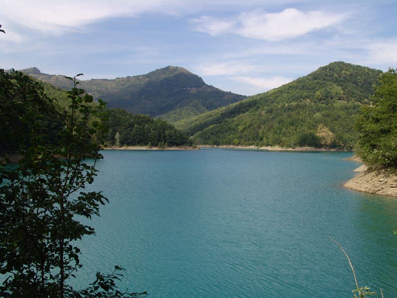
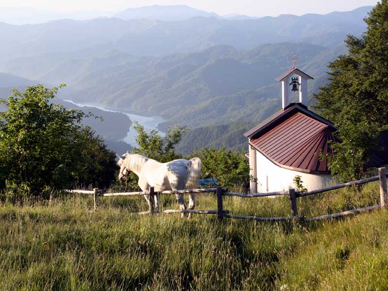
Upper Val Trebbia
In Upper Val Trebbia, the exclusive charm of the natural
environments is enriched by the rare presence of scattered villages on
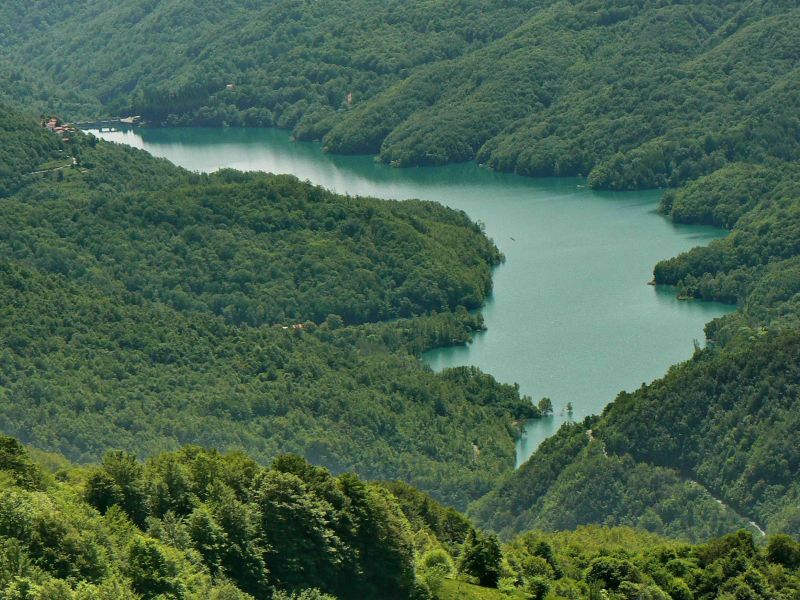
the ridges. Moreover, the presence of rich basins and watercourses (Brugneto Lake,
the Terenzone, Cassingheno, and Trebbia streams) and of great beech
tree woods, increases the naturalistic value of this valley. In
particular, the stream Trebbia, with its clear waters and its typical
meanders, represents a traditional point of interest for tourists and
sport-loving people. There are many evidences of the rural civilization
and of its influence on the landscape.
The meadows and the
pastures, still used for summer grazing, give the possibility to
appreciate a rich flora characterized by several rare and protected
alpine species and a fauna consisting in several endemisms and more
common animals (fallow deer, roe deer, foxes, and other mammals,
together with amphibians, reptiles, birds, and the wonderful
butterflies coloring the meadows of Antola).

The Park also Means...
- Support to traditional activities: One
of the main aims of the Park is to promote sustainable activities:
agricultural and breeding activities, tourist, artesanal, commercial
activities, and everything which can contribute to the development of
the territory.
- A better use of the territory: In
order to use better the territory of the Park it is necessary to
improve and differentiate the welcome structures of the Upper Valle
Scrivia and Upper Val Trebbia; moreover, it is necessary to enhance the
value of sports and spare time activities which can be carried out in
the open air.
- Environmental Education: The
Park offers an environmental education service for schools and updating
courses for teachers; on the teacher's request, it is also possible to
agree about specific issues and projects.
- Maintenance of the territory: The
Park Authority has promoted an initiative to maintain paths and
agricultural firms, cooperatives, and local associations, in order to
improve their accessibility and use.
- Local Products: Visiting our territory, it is possible to taste our local products thanks to the Rete di Mercato Locale made of small and medium firms and to know the products of craftsmanship.
- Scientific research: Particular attention is dedicated to scientific and cultural research; to this aim, some "university sections" have been established on the Park's territory thanks to an agreement with the University of Genova.
Environmental Certification
The Antola Park Authority undertook the process to obtain the ISO 14001 Environmental Certification. After the initial Environmental Analysis of the Park's territory, and after a further evaluation of the Environmental Features, which made it possible to highlight the Park's most significant actions, with the Decision of the Park's Council n. 9 of the 22nd June 2012 the Environmental Policy was approved. The document regards the principles, the goals and the useful actions to implement an ISO 14001 environmental management system.
Download the PDF of the document for a free consultation.
 Environmental Policy (PDF - 273Kb)


