Protected Area
Identity Card
- Dolomiti di Ampezzo Regional Park:
- Land Surface Area: 11'320.00 ha
- Regions: Veneto
- Provinces: Belluno
- Municipalities: Cortina d'Ampezzo
- Establishment Measures: LR 21 22/03/1990
- PA Official List: EUAP0242
- Park Authority: Parco Naturale delle Dolomiti d'Ampezzo
- Further managed Protected Areas:
- SIC e ZPS Dolomiti di Ampezzo
The Park
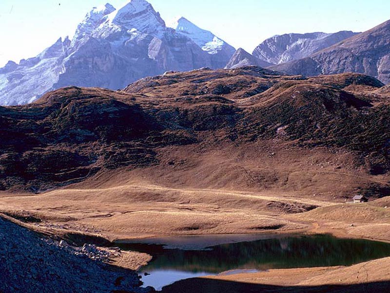
Dolomiti d'Ampezzo Park was established on
22/3/1990 with the Regional Law no. 21 of Venetia. It covers
11,200 hectares in the north of the town of Cortina, at the border
between Venetia and Alto Adige, in the heart of the eastern Dolomites.
It is based on the ancient and joint ownership of the so-called Regole d'Ampezzo,
entirely included in the Municipality of Cortina. They were in the past
associations created by the local families which wanted to promote the
collective and joint exploitation of the local pastures and forests;
their creation dates back to the period of the first permanent
settlements in the Ampezzo Valley, at the time of the Celtic and Roman
colonization. The Regole have been recognized by the State and
by the Region: they are the historical and cultural foundations of the
area, and the Park has been created with their approval in order to
allow the preservation of the environmental heritage of the Ampezzo
Valley.
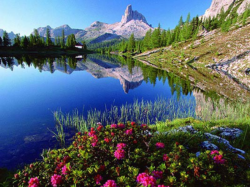
The protected area is wedge-shaped and presents two lateral branches, which become part in the North of the Parco altoatesino di Fanes, Senes e Braies: they form together a protected territory with homogeneous environmental features which extends on the whole for 37,000 hectares. The territories of the Park are also homogeneous as far as the exploitation of the soil is concerned, since there are neither technological tourist structures - such as Alpine skiing tracks or chair-lifts - nor urbanized areas and villages. This makes clearer the distinction between the areas which are exclusively dedicated to forests and pastures and the areas dedicated to the natural reserve. The protected area includes the mountain groups of the Tofana, Fanes, Col Bechei, Croda Rossa d'Ampezzo, and Cristallo, divided respectively by the Travenanzes valley, the valley of Fanes, the high valley of the Boite, and the Felizon valley; the valleys are narrow and enclosed towards the common confluence where the entrance of the Park is situated, and they open in wide pasture plateaus towards the highest altitudes. Two valleys form the southern borders of the protected area on its lateral branches: the valley of rio Falzarego in the West and the Padeon valley in the East. The highest peaks reach 3,200m of altitude and conceal on their northern slopes some little glaciers. The Tofana and the Cristallo are characterized by high rocky walls which often reach the forests of the subalpine area, while the massifs of the Fanes and of Croda Rossa present less difference in height and alternate with wide karstic plateaus and high-mountain grasslands.
Further information
History
In the northern part of the Ampezzo valley, stock rearing was already practiced in the past; some toponyms witness a Celtic presence (Gótres, Antruiles, Lerósa) even if there have never been permanent settlements; the presence of the man-shepherd has always been seasonal.
In ancient times, the current area of the Park was divided, for the exploitation of the pastures, between the Regole di Larieto and Vinigo; the second, whose consorts lived at twenty kilometers of distance from Ampezzo, in Cadore, was entitled to the pastures of Gótres and Lerósa, the Felizon valley and Travenanzes valley (this is the explanation of the toponym "Ponte dei Cadorìs" at the mouth of the Travenanzes valley).
Further information (Italian text)