


Points of Interest
In the Park territory there are some points of particular interest.
They are areas telling the tale of our place and characterizing its environment.
The following list can be helpful to give you the opportunity to discover the territory.
- Valcellina (Andreis, Cimolais, Claut, Erto e Casso)
- Val Meduna (Frisanco, Tramonti di Sopra)
- Val Tagliamento (Forni di Sopra, Forni di Sotto)
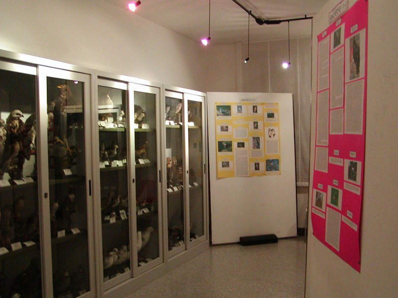
Avifaunistic Area
Valcellina - Municipality of Andreis (PN)
The most interesting point for the public is without a doubt the area dedicated to the aviaries, which is situated above the town of Andreis. Within them there are many species of birds, like hawks, kestrels, buzzards, tawny owls, sparrow hawks, goshawks, and a golden eagle. Some of them have injuries which do not allow them to be free. Others are treated and subsequently freed; in the meanwhile they are placed in an equipped aviary, until they are completely rehabilitated.
Each freeing becomes for the Park an occasion of environmental education activity with groups or schools.
The Avifaunistic Area in Andreis consists of:
- a rehabilitation center for the wounded avifauna with ambulatory vet clinic
- a nucleus of aviaries
- a didactic-ornithological hall and ornithological exhibit
- a naturalistic workshop.

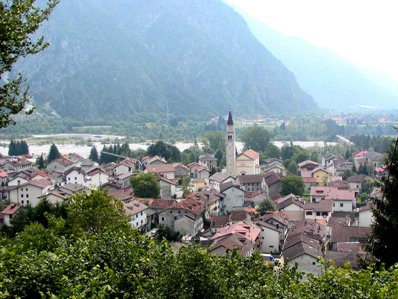
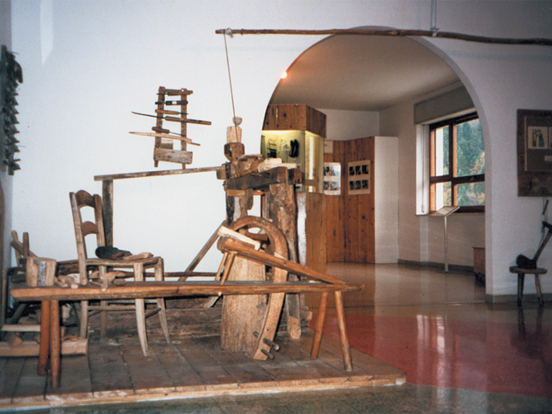
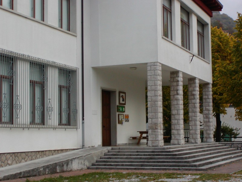
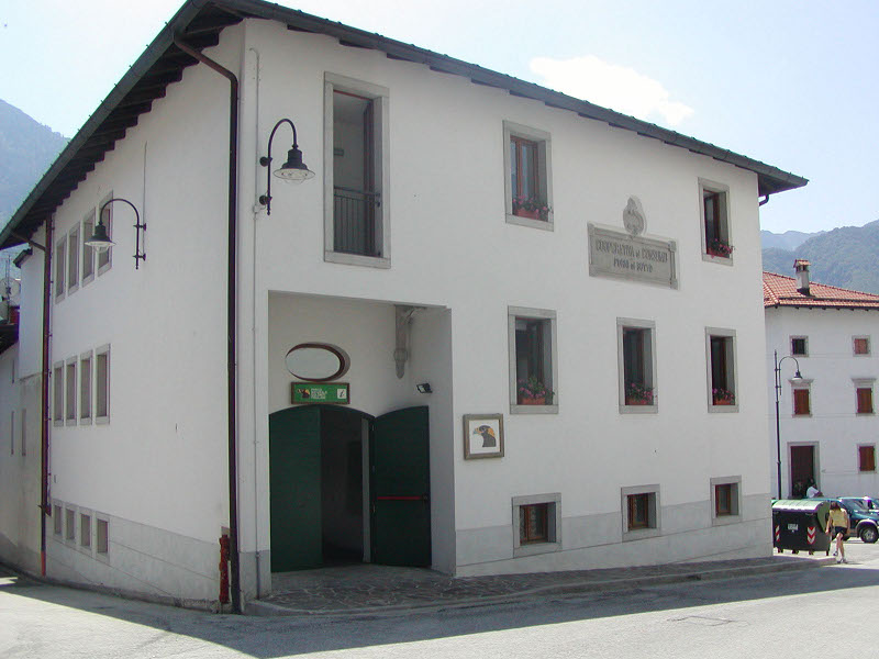
Ethnographic Museum of Rural Art and Culture in Andreis
Valcellina - Municipality of Andreis (PN)
Museo dell'Arte e Civiltà Contadina di Andreis (Ethnographic Museum of Rural Art and Culture in Andreis) situated in the offices of the former Town Hall nearby the square, was open to the public in July 1981.
Several visitors coming both from Italy and from abroad could see the objects and the tools preserved in it. In particular, you can admire the reconstruction of the typical house of Andreis inside, the blacksmith's forge, the bone tobacco-boxes and combs, the beautiful Easter rattles (cràceles), the working of the "scarpetes" and many other things. (Museum guidebook - Municipality of Andreis 2001)
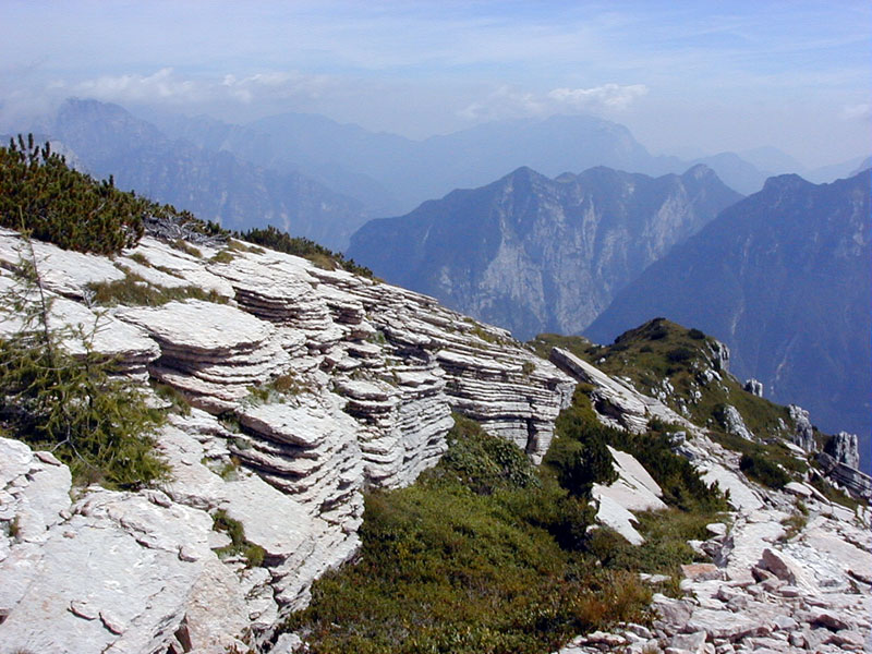
Nature Trail Mt. Ciavac and Periadriatic Fault
Valcellina - Municipality of Andreis (PN)
The Periadriatic Fault is an important tectonic fault (fold-fault) crossing from the East to the West the whole region of Friuli. The fault's slip plane causes the overthrust of the Main Dolomia and unites rocks belonging to different periods and levels. The friction caused by the overthrust generates an intense fracturing. This looks like a loose mass of detritus in which it is possible to find smooth and reflecting surfaces. The fault can be seen from a distance as it seems a bare rocky formation overlooking the meadows of the village of Andreis and situated below the steep woods of Monte Raut.
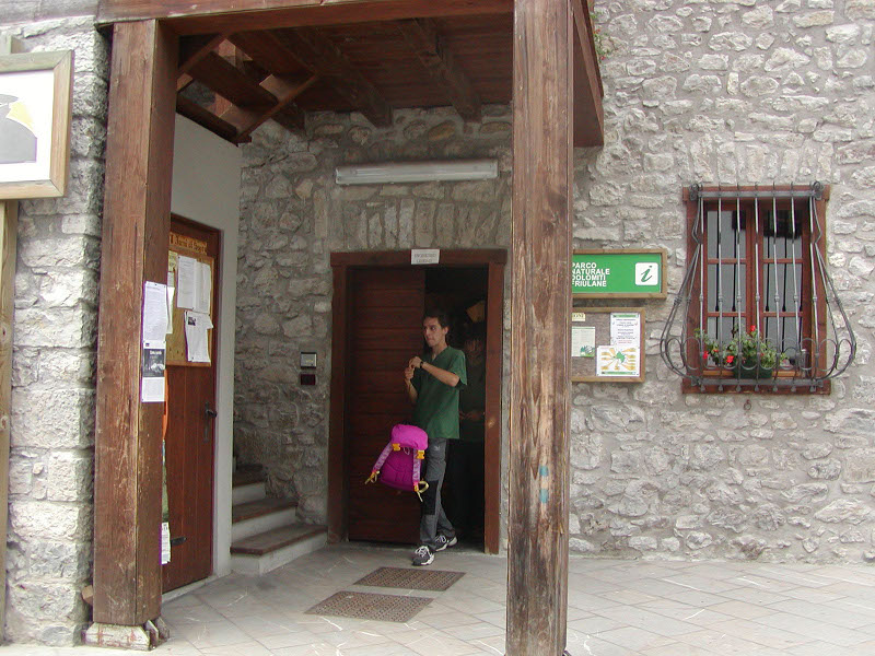
Cimolais Visitor Center
Valcellina - Municipality of Cimolais (PN)
It is useful if you want to draw yourself nearer for the first time to the reality of the Park.
Do you want to discover to which animal the most common tracks you will find within the Park belong to?
Or observe closer an ammonite dating back to the Jurassic period? If
you want to know the naturalistic aspects there is a didactic route
illustrating fauna, flora, rocks, and vegetation. A short introduction
to make the visitor understand the surrounding natural landscape.
Val Cimoliana
Valcellina - Municipality of Cimolais (PN)
Val Cimoliana is situated in the Dolomites of Oltre Piave, in the upper
Valcellina, at the middle-western border of Friuli-Venezia Giulia with
Veneto. From the town of Cimolais it tortuously develops for about 18
km in direction NNE among steep slopes shaped by glacial erosions, and
on a bed covered by alluvial deposits transported by the stream
Cimoliana.
The mountain complex preludes the Alpi Carniche, but from
a geological and environmental point of view, it is nearer to the
Dolomites. Pinnacles and keeps stands out against the sky, eroded by
atmospheric agents and creating incredible games of balance like the
Bell Tower of Val Montanaia, standing out isolated in the middle of a
glacial basin. Stretta di Gote offers a charming landscape among
high vertical walls at a few meters one from the other, engraved by the river erosion.
Val Montanaia Bell Tower
Valcellina - Municipality of Cimolais (PN)
Val Montanaia Bell Tower is situated in the homonymous valley, in the Upper Val Cimoliana area. It is a spectacular pinnacle of 300 meters of height and it has a base of 60 meters. It stands out in the middle of the valley, in a unique position.
This formation is the result of the Alpine erosion carried out by the wide glaciers which covered the main valleys and gave them their current shape. All the expert alpinists know it; its peak was first reached in 1902 after a very strenuous and hazardous climbing. The climbing is now safer thanks to more suitable equipment, specific and appropriate techniques and training. All these improvements, of course, do not diminish the risk of the hike. Val Cimoliana is the easiest trail if you want to approach and admire the "Bell Tower".
Bregoline Trail: Casera Bregolina Grande
Valcellina - Municipality of Cimolais (PN)
This itinerary develops in the Pramaggiore (Pramaór) mountain range and offers the most charming views over the Dolomitic peaks of Spalti di Toro and Monfacloni, which are real jewels set in the wonderful Val Cimoliana (Thimoliana).
Dinosaur Footprints in Casera Casavento
Valcellina - Municipality of Claut (PN)
In the morning of 30th September 1994, a group of students visiting the
Park discovered by chance the first fossil footprints of Dinosaur of
the Park. They were imprinted on a Dolomitic boulder dating back to the
Triassic period, that is more than 200 million years ago. The Dinosaur
footprints found in the Main Dolomia of the Dolomites open a very
interesting issue, since their discovery demonstrates without a doubt
that the presence of the dinosaurs in the Italian peninsula was not
occasional as it was always thought to be.
This first discovery led to further researches in the territory of the Park, which only confirmed it.
The footprints which have been found in Casera Casavento (which can be
observed on a boulder situated in the nearby stream called Ciol de
Ciasavent), are still the most visited and appreciated.
You will be led along the itinerary by signals and panels.
Brochures-guidebooks are available in the Visitor Centers, in the Information Points, and in the Town of Claut.
Museum Casa Clautana
Valcellina - Municipality of Claut (PN)
The museum gathers evidences of the local community history and works within the plan of tourist and environmental enhancement of Dolomiti Friulane Regional Park and of the Municipality of Claut. In particular, it describes the life of the women of the valley, entirely dedicated to houseworks, to the work in the field, in the stable, and as seller of the wooden tools men used to build during the winter. The aim of the Museum is also to recover ancient structures created to use water, stone, wood and the restoration of a "ciasa da fum", ancient private house which has been purchased to be dedicated to the museum.
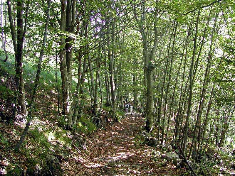
Col dei Piais and Truoi de l'Arthith Nature Trail
Valcellina - Municipality of Claut (PN)
These two itineraries - which can be combined - are part of the Park "Sentieri Natura", easily accessible paths, suitable for everyone. After going beyond the old village of Massurie, follow the easy and moderately steep trail in Col dei Piais, while among the green meadows of Arthith another itinerary will lead you back through a short and relaxing walk.
Strada degli Alpini
Valcellina - Municipality of Claut (PN)
The itinerary gives you the opportunity to go along the path traced by the Alpini during the first years of the 20th century, which became a theater of the violent struggles of World War I. The itinerary is also interesting from a geological point of view thanks to the recent discovery of the fossil footprints of a dinosaur near Casera Casavento.
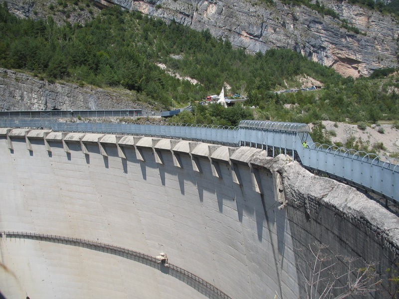
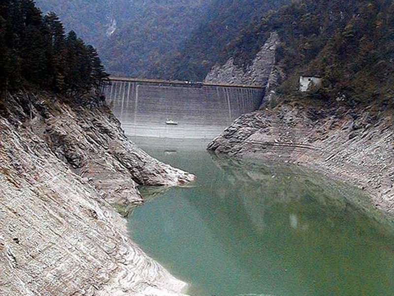
Vajont Landslide and Dam
Valcellina - Municipality of Erto e Casso (PN)
Between the 50s and the 60s, the stream Vajont was blocked by a dam at a few hundred meters from the confluence with the river Piave. The hydroelectric plant was never officially used because a huge landslide partially filled the basin giving birth to a terrible wave: the towns along the lake, Longarone and other villages were destroyed and more than 2.000 people died. The Landslide of the Vajont is only the most recent and dramatic event in the recent life of a mountain, during which the rocks formed, were lifted, and were subject to erosion. The construction of a dam in a valley that was geologically unstable is one of the main causes of the huge landslide (270 million cube meters) that in the evening of 9th October 1963 took off Monte Toc and rapidly fell in the already partially filled lake. The 265-meter high arch dam was the highest in the world and was able to stand the unprecedented destructive power of the landslide and of the subsequent wave.
The Vajont valley, with the villages of Erto and Casso situated on very steep slopes, still bears the marks of the disaster. Indeed, the event began before that dramatic night, when the building of the dam led to the loss of the few and poor resources of the people living at the bottom of the valley.
In the Visitor Center of Erto you can visit the Exhibit "La Catastrofe del Vajont", uno spazio della memoria", a real documentation center describing the phenomenon in all its stages. Near the Dam there is an Information Office with seasonal opening.
Erto e Casso Visitor Center
Valcellina - Municipality of Erto e Casso (PN)
The Visitor Center in Erto is entirely dedicated to the disaster of Vajont of 1963. It is divided into two sections:
- The first section "Vajont Immagini e memorie" houses a rich collection of classic photos.
The route will lead you back in time to discover traditions, uses and costumes of the population of Vajont before the tragic event which took place on 9th October 1963, until the fateful night when the huge landslide broke away from Mt. Toc and fell into the artificial lake, causing 2000 victims. - The second section: "Uno spazio della memoria" describes in a detailed and scientific manner the whole event, from the planning of the hydroelectric basin of Vajont up to the trial.
Everything
is told through descriptive panels. Moreover, you can see tables,
graphic representations, and compare descriptive relief models.
In the multimedia hall a cd-rom gives you the opportunity to have an
overall view of the disaster, to observe the graphic reconstruction of
the landslide, and to watch original videos of that time.
Therefore, the Visitor Center in Erto is an important and complete
documentation center on the disaster of Vajont and it represents a
valid reference point for studies and research.
The Coal Trail
Valcellina - Municipality of Erto e Casso (PN)
This itinerary is the ideal link between the entrance of the suggestive Val Zemola and the village of Casso. The path was once used to carry the vegetable coal coming from the woodlands of the Val.
Trail 'Between Legend and Reality'
Valcellina - Municipality of Erto e Casso (PN)
It is a route crossing the village of S. Martino in Erto and leading us to the discovery of the ancient legends handed down in the valley, above all the one of the castle of Queen Claudia...
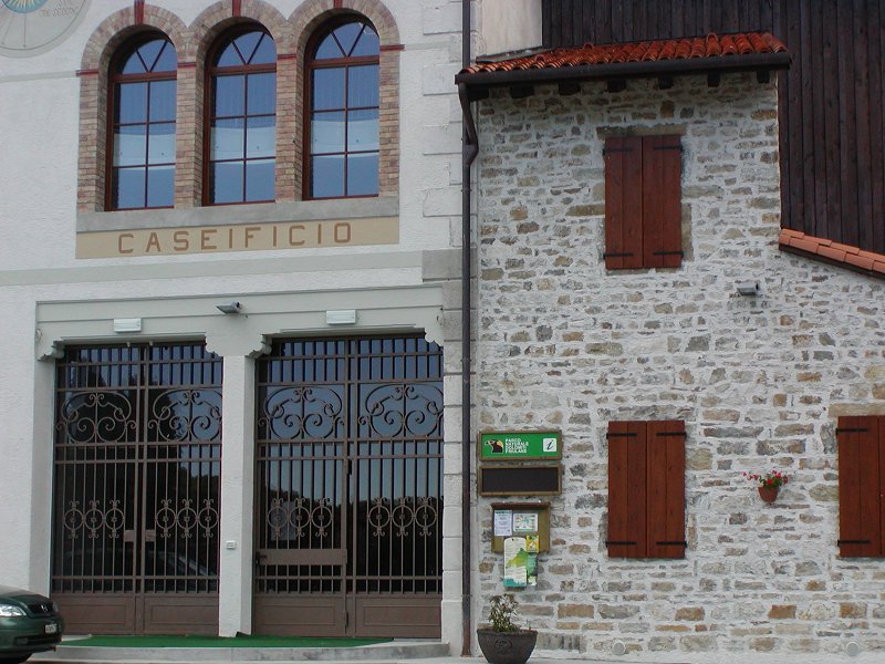
Poffabro Visitor Center
Val Meduna - Municipality of Frisanco (PN)
Open since autumn 2003 with the exhibit on the art of cheese-making.
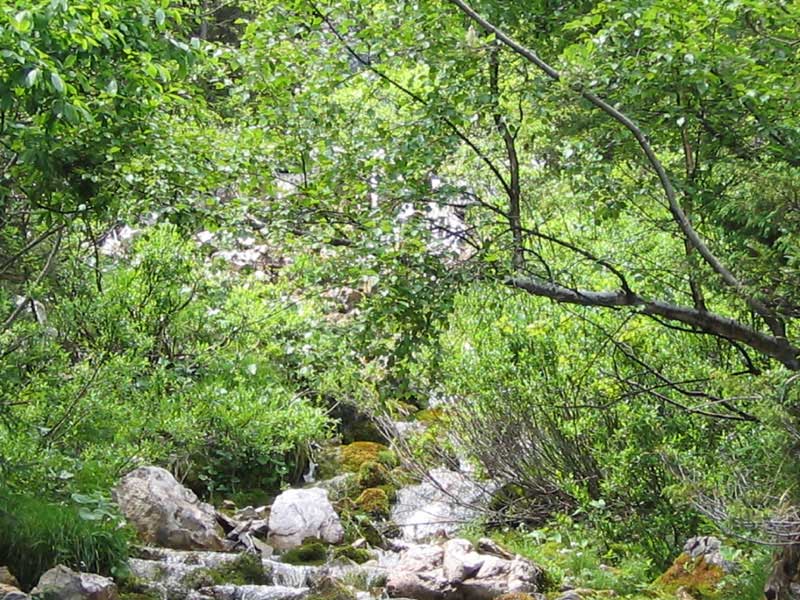
Landris Nature Trail
Val Meduna - Municipality of Frisanco (PN)
It is a route leading to the discovery of the particular features of the Park among fauna, vegetation, landscape, and rocks.
Lago del Ciul Trail
Val Meduna - Municipality of Tramonti di Sopra (PN)
The itinerary leaves from the mountain town of Tramonti di Sopra, enters the wildest area of the Park by following a path which was once extremely important for the economy of the area; this leads to the abandoned country hamlets of Frassaneit, and then to the artificial lake of the Ciul.
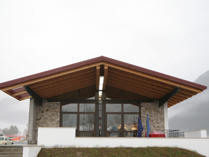
Forni di Sopra Visitor Center
Val Tagliamento - Municipality of Forni di Sopra (UD)
The Visitor Center houses the exhibit "La vegetazione del Parco": the
route describes the different vegetal environments of the protected
area, their evolution, the features of some particularly interesting
botanical species housing also exhibits dealing with herbs and
mushrooms.
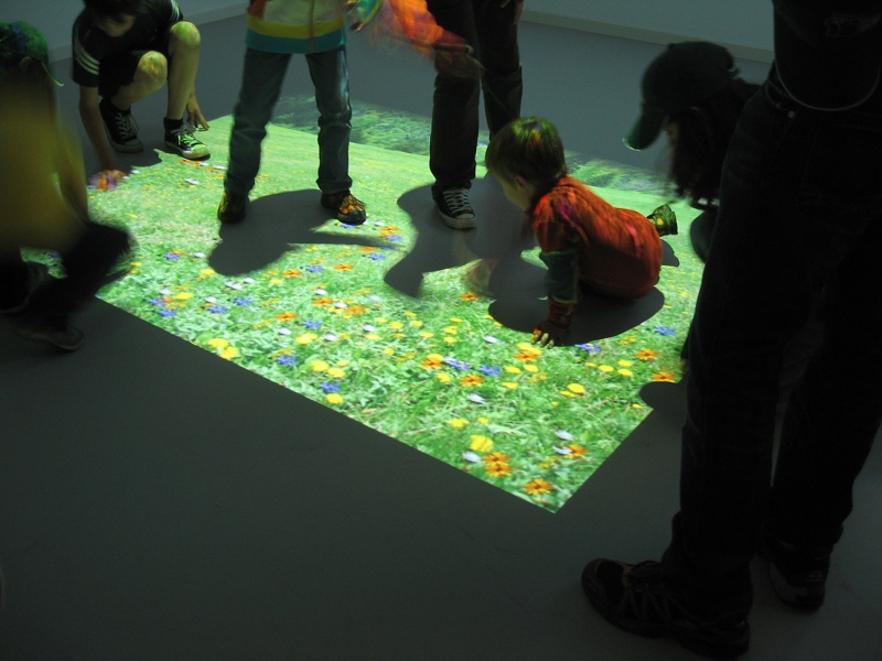
The "Sentiero del bambino" is linked to the Visitor Center: it is a
naturalistic itinerary developing at the bottom of the valley, suitable
for groups of students or families.
The Children's Trail
Val Tagliamento - Municipality of Forni di Sopra (UD)
Didactic-hiking itinerary used within environmental education activities.
Truoi dai Sclops Trail
Val Tagliamento - Municipality of Forni di Sopra (UD)
It is the most fascinating itinerary in the Fornese slope of the Park. Known as Truoi dai Sclops ("Sentiero delle Genzianelle"), it is important for its botanical peculiarities which can be commonly found in the Dolomites. Copses of Mugho pines, screes, pastures, and alpine meadows are the natural background for this itinerary.
Forni di Sotto Visitor Center
Val Tagliamento - Forni di Sotto (UD)
The Visitor Center houses the exhibit "Le tipologie forestali del Parco", illustrating the main forest features of the protected area and how their exploitation, the silviculture, and deforestation have changed in time. The Visitor Center is linked to an interesting route going along the nearby Val Poschiadea, where an old "Valtellina" cableway has been installed.
Val Poschiadea Cableway
Val Tagliamento - Forni di Sotto (UD)
Val Poschiadea cableway has been reconstructed exactly as it could be seen until the early 60s.
It
is an important work of forest archaeology, a relative of the modern
cableways. It was used in the past to transport the timber coming from
the woods to the valley.
Val Poschiadea cableway works
according to the activities organized by the Park Visitor Center in
Forni di Sotto, promoting at the same time silviculture and the
collection of timber used by the local population.
Forcella Lareseit Trail
Val Tagliamento - Forni di Sotto (UD)
This itinerary leads us to the discovery of the landscape between the main area linking the valley of the Upper Tagliamento to the one of the Upper Valcellina. The route goes up to Val Poschiadea, where the presence of thick woods works as a good natural defense against the considerable activity of erosion.


