Protected Area
Identity Card
- Land Surface Area: 7'186.00 ha
- Regions: Umbria
- Provinces: Perugia
- Municipalities: Assisi, Nocera Umbra, Spello, Valtopina
- Establishment Measures: LR 9 03/03/1995
- PA Official List: EUAP0236
The Territory
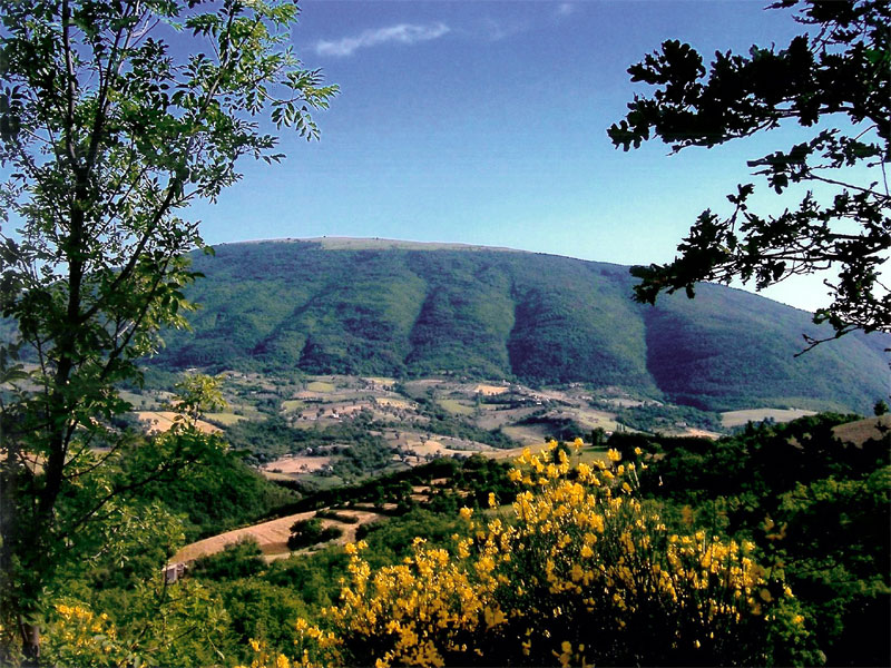
Subasio Park consists of the mountain system named after
the homonymous mountain, probably the most famous mountain in Umbria,
which stands almost isolated at the southern tip of the chain,
delimiting Valle Umbra in the east and dominating with its 1,290m of
height its valley and hilly landscape.
The Park borders are marked
by the course of Tescio in the north, by the stream Chiona in the
south-east, by Topino in the east and in the south-west by an ideal
line connecting the two spurs of Mt. Subasio massif where Assisi and
Spello rise, running parallel to Valle Umbra. As far as morphology and
territory are concerned, the main feature of the area is Mt. Subasio,
probably the most famous mountain of Umbria: with an elliptical shape
and north-west/south-east orientation, it is an isolated mountain with
a rounded and "turtle back" silhouette dominating the surrounding
landscape.
In the 10th century BC Subasio acquired a holy and
mystical meaning for the local population, which became stronger with
St. Francis and his monastic order.
"Cantico delle Creature" is an
extraordinary document of admiration and love for nature and Mt.
Subasio, with the possible references made to it in Cantico, is an
ideal place to create a Literary Park across which we can be led by the
lines written by the saint friar from Assisi.