

Route 696a
Valle Granara - Fonte della Moscosa - Monte Piano - Monte Viglio - Valle Fura - Valle Granara (ring route)
- Trail Conditions: On foot
- Interest: Wildlife, Geology, Panorama
- Departure: Valle Granara (1,371m)
- Duration: 5 hour/s 10 minutes
- Difficulty Level: EE - For expert hikers
- Length: 13 km
- Difference in height: Uphill 916m - Downhill 915m
- Minimum Altitude: 1,310m
- Maximum Altitude: 2,160m
Reach the hairpin turn a little beyond the chair lift departure station, in the locality of Granara Valley. Walk the large dirt road leading into the wood up to a wide clearing. A well visible marked path continues in the same direction, along the trench. The rise becomes steeper, go out of the wood and after a few meters reach the Fonte della Moscosa.
Further information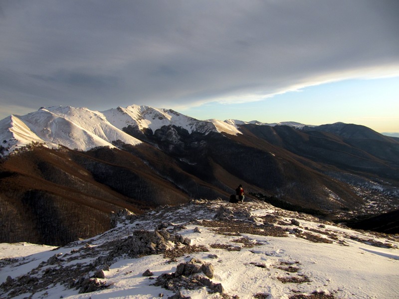
Itinerary 696a
 Download KMZ
 Download in GPX format
Books and Guides

Protected Area(29.990,00 ha)

Lay-out of the itinerary

Departure

Arrival

Park Authority Offices

Visitor Centers (9)

Where to Sleep* (1)

Municipalities (8)

Points of Interest (78)

Photos (153)

Videos (21)

Pic-Nic Area (36)

EV charge ≥100kW (286)

E-Bike charging (9)

Airports (1)

Highway exits (1)
*: only Operators with Accommodation Page


© 2024 - Parco Naturale Regionale Monti Simbruini