Protected Area
Identity Card
- Monti Simbruini Nature Park:
- Land Surface Area: 29'990.00 ha
- Protected flora: 1 species (Italian text)
- Protected wildlife: 69 species (Italian text)
- Habitats: 8 types (Italian text)
- Regions: Lazio
- Provinces: Frosinone, Roma
- Municipalities: Arsoli, Camerata Nuova, Cervara di Roma, Filettino, Jenne, Subiaco, Trevi nel Lazio, Vallepietra
- Establishment Measures: LR 8 29/01/1983 - LR 29 06/10/1997
- PA Official List: EUAP0186
- Park Authority: Parco Naturale Regionale Monti Simbruini
- Further managed Protected Areas:
- Zona di Protezione Speciale Monti Simbruini ed Ernici
- Zona Speciale di Conservazione Alta Valle del Fiume Aniene
- Zona Speciale di Conservazione Campo Catino
- Zona Speciale di Conservazione Castagneti di Fiuggi
- Zona Speciale di Conservazione Grotta dell'Arco - Bellegra
- Zona Speciale di Conservazione Grotta dell'Inferniglio
- Zona Speciale di Conservazione Monte Autore e Monti Simbruini centrali
- Zona Speciale di Conservazione Monte Ortara e Monte La Monna
- Zona Speciale di Conservazione Monte Passeggio e Pizzo Deta (area sommitale)
- Zona Speciale di Conservazione Monte Passeggio e Pizzo Deta (versante sud)
- Zona Speciale di Conservazione Monte Tarino e Tarinello
- Zona Speciale di Conservazione Monte Viglio (area sommitale)
- Zona Speciale di Conservazione Sorgenti dell'Aniene
- Zona Speciale di Conservazione Valle dell'Inferno
- Zona Speciale di Conservazione Versante Meridionale del Monte Scalambra
![]() System Plan (3.4Mb)
System Plan (3.4Mb)
Monti Simbruini Regional Park
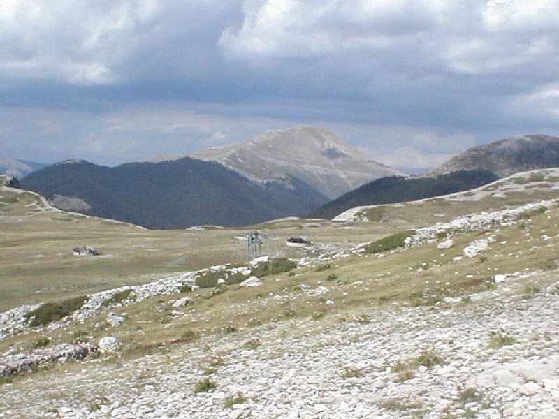
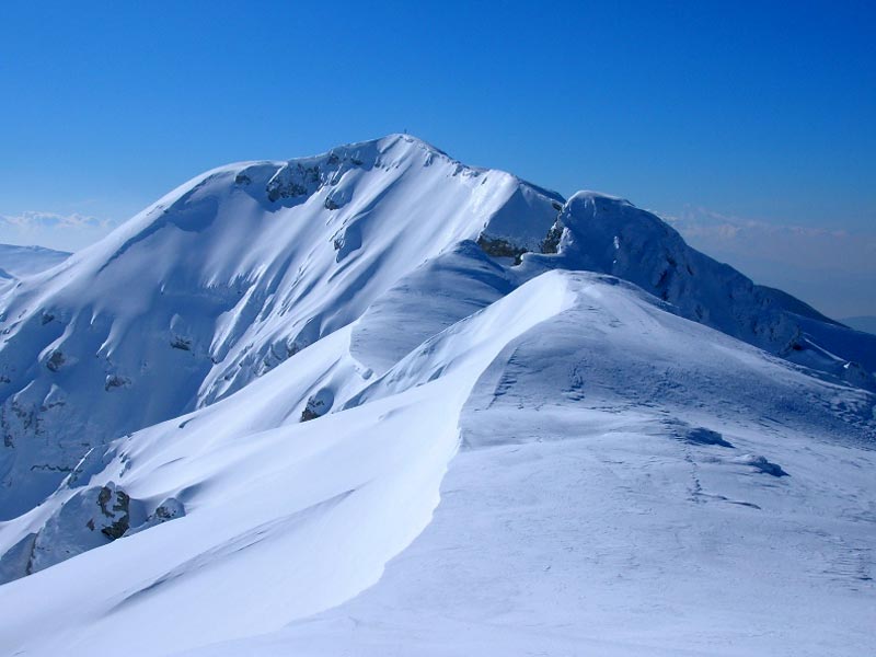
Monti Simbruini Regional Park, the largest protected area of Lazio, is situated between the Provinces of Roma and Frosinone and covers an area of 29,990 ha. It involves seven Municipalities situated between the 408 and 1,075m of altitude: Jenne, housing the Park Headquarters, Subiaco, Camerata Nuova, Cervara di Roma, Filettino, Trevi nel Lazio, and Vallepietra.
The name Simbruini derives from the Latin sub imbribus, meaning "under the rain", and witnesses the important role the water plays in the area. The ancient Romans already used the great resource water: Emperor Nero built a villa near Subiaco along the course of the river Aniene, with three artificial lakes, but above all important aqueducts to supply Rome were built (Anio Novus, Marcio, and Claudio). The springs in the Park territory still supply the Capital with drinking water. The mainly mountain territory is characterized by the presence of two watercourses: the river Aniene, springing in one of the most charming places of the Park in loc. Fiumata in the Municipality of Filettino, and the stream Simbrivio, springing upstream the town of Vallepietra beneath SS.Trinità Sanctuary. The two rivers are surrounded by Simbruini mountains: the summits of Mt. Viglio (2,156m) and Mt. Tarino (1,961m), Mt. Autore (1,855m) where you can enjoy a particularly charming view, and Mt. Cotento (2,015m) dominating the town of Filettino. The mountain chain alternates with various karstic plateaus, flat areas surrounded by slopes covered with beech trees, where it is easy to find dolines and swallow holes witnessing the water action on the rock over the centuries. Inferniglio Cave in the Municipality of Jenne and Pozzo del Gelo in Camerata Nuova are some examples. Among the most interesting karstic plateaus, there are Camposecco, Campaegli, Campo Buffone, Fondi, and Ceraso. A visit to the Park may also focus on past evidences, with a historical excursus embracing millennia. From the Saracen walls in Filettino, dating back to the 4th - 5th century BC, to the ruins of the old town of Camerata, destroyed by a fire in 1859, across Jenne historical town center with the rests of the castle where Pope Alexander IV was born and the imposing Caetani Castle in Trevi nel Lazio, covering an area of about 800 square meters. However, the two main attractions are without a doubt SS. Trinità Sanctuary in Vallepietra - one of the few Sanctuaries in Italy dedicated to the Holy Trinity, destination of several pilgrims entering Mt. Autore cave to worship the image the blessing Holy Trinity - and Subiaco town center, rich in historical features: San Francesco Monastery (1327) and the nearby medieval bridge (1356), the triumphal arch (1787), Sant'Andrea Concathedral (1789), and the characteristic quarter developing around Rocca dei Borgia, where Cesare and Lucrezia Borgia were born.
Immediately outside Subiaco, climbing along Valle Santa, you will find the ruins of Emperor Nero's Villa, built next to the three artificial barrages of the river Aniene, as well as Santa Scolastica and San Benedetto Monasteries, worth a visit for the artistic treasures they preserve and the spiritual atmosphere surrounding them. Another interesting place to visit is Cervara di Roma, where art, culture, and nature integrate and form an unicum leaving unforgettable feelings and memories. Cervara is a museum in the open air, with its several rock sculptures and the poems you can read along the alleys and staircases characterizing the small town center.
Wildlife
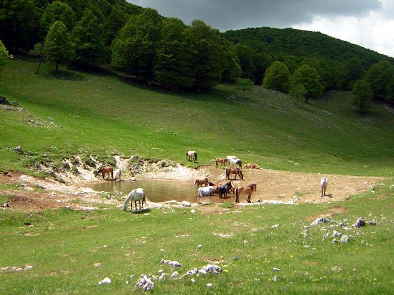
Despite it is situated near Rome, Monti Simbruini Park houses several animal species of great conservation value characteristic of the Apennines. There are populations of wild ungulates, like the wild boar and roe deer enabling the survival of at least two wolf packs - in Italy only 600 specimens survive. Sometimes, in the woodlands and on the summits covered with snow it is possible to find the tracks of the brown bear, a very rare and endangered bear species - less than 50 specimens survive.
The Park has started a red deer reintroduction program to favor the populations of the two big carnivores.
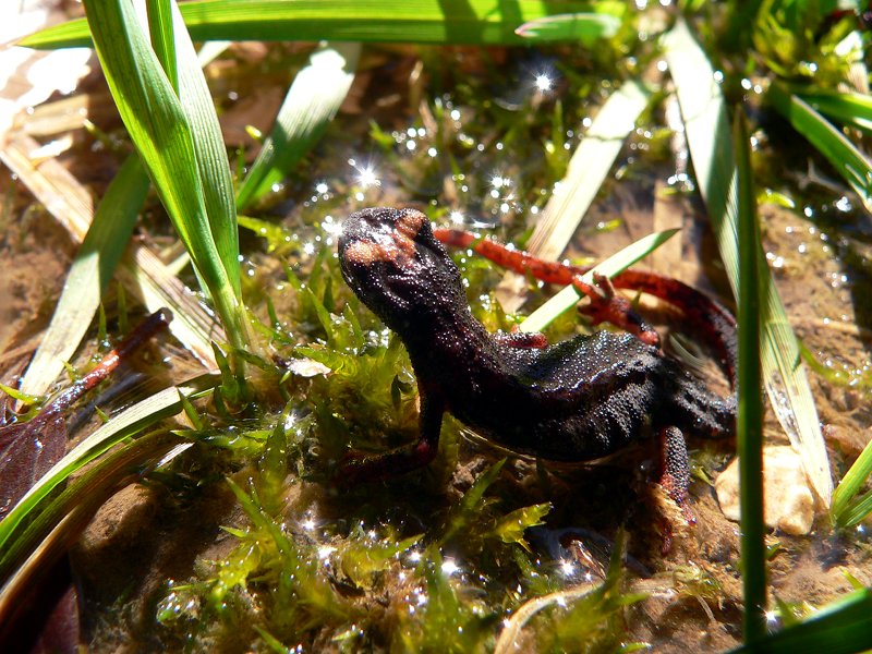
In the Park, 105 bird species nest, out of which 12 birds of prey. The territory of Simbruini houses one of the few eagle nests of Central Italy and several passerine species specialized in the high-mountain and stream life. The Rock Partridge, another very rare species, populates the mountain summits. The resurgences and wetlands are populated by particular amphibians, one of which, the Spectacled Salamander, is an endemic species of Central Italy.
Monti Simbruini Park started a series of projects dealing with these complex issues: after a detailed scientific research, the red deer has been reintroduced, and wildlife areas for the roe deer and red deer have been created. The Park Authority will soon have to prepare a Management Plan for an International Biodiversity Study Center. Moreover, a Wildlife Recovery Center has been just opened and will serve the whole Central Italy. The Park has also committed itself to deal with two "opposite and complementary" issues: poaching and the damages caused by the wildlife, in particular by the wild boar.
- Wildlife of High Mountain Environment
- Wildlife of Mountain Environment
- Wildlife of Low Mountain Environment
- Wildlife of River Environment
- Wildlife of Subterranean Environment

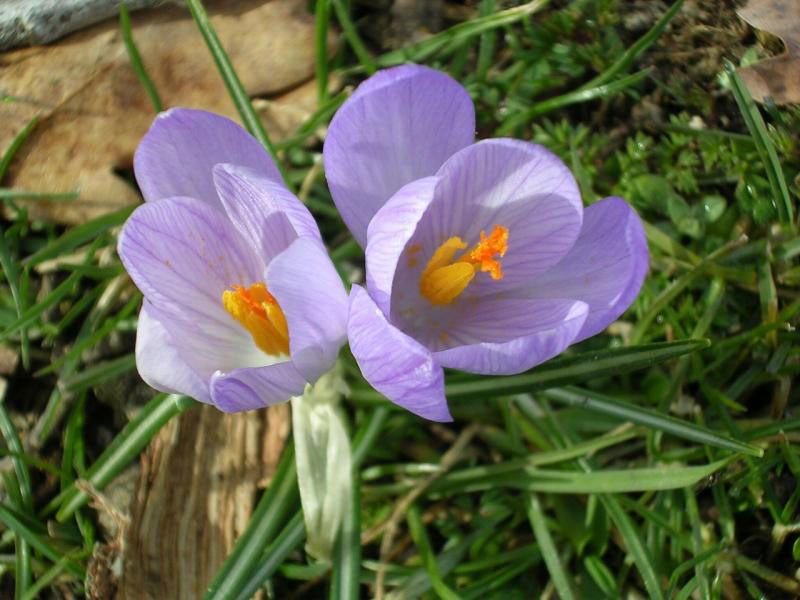
Flora
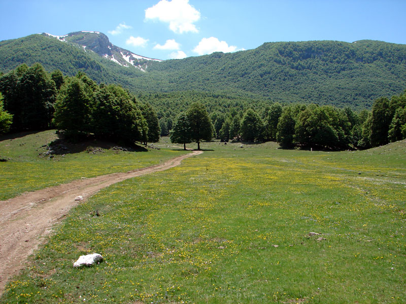
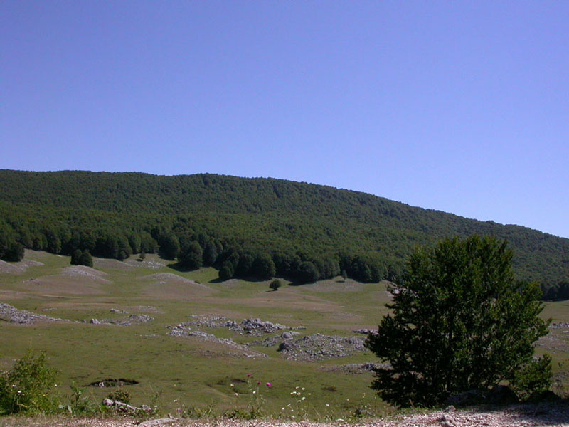
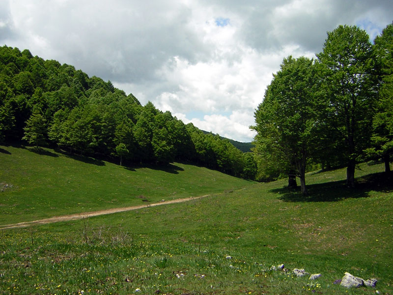
The vegetable landscape of Monti Simbruini Regional Park has a great environmental value. Its geographic position, as well as a series of factors, give the opportunity to find here both characteristic vegetable species of the central European regions and characteristic species of the Mediterranean coasts. Moreover, the highest summits are covered with the characteristic subalpine vegetation. The territory is mainly covered with woodlands (about 25,000 ha). Without a doubt, the largest formation is the beech wood growing from 900 to 1,900m of altitude. The dominating beech tree grows together with the European Rowan, the Ash Tree, the Sycamore Maple, and the Norway Maple, as well as with other two rare species: the yew, known for its poisonousness, and the holly, which is considered a Tertiary relict, since it was a very widespread species in the Tertiary period and then considerably reduced its distribution area because of the Quaternary glaciations. Since they are relatively young populations (of about 60 years, since after the war they have been exploited a lot), they have a poor undergrowth because of their low and thick covering. In the clearings, besides the nitrophilous flora (Urtica, Geranium, Mercurialis) it is possible to find showy plants like the deadly nightshade and the daphne.
Beneath the beech wood vegetational limit, there are pure or mixed woods of deciduous oak species, like the Turkey oak and the downy oak, or the hop hornbeam; in such formations it is also possible to find other species like the flowering ash, the field maple, and the Italian maple. The evergreen holm oak is another species of great landscape interest growing on the steep and sunny slopes.
- Flora of High Mountain Environment
- Flora of Mountain Environment
- Flora of Low Mountain Environment
- Flora of River Environment
- Flora of Subterranean Environment
Further information (in Italian)

Geological features
The Simbruini Mounts almost only consists of mesozoic units in carbonate platform facies developed between the late Triassic and part of the late Cretaceous (220-60 million years old).
A few deposits, more recent carbonate ones but in different facies ("saccaroid limestone" and "bryozoan limestone" of the early Miocene), can be observed in the northern edge of the ridge. Siliciclastic sedimentary rocks dating back to the late Miocene can be found only southeast, in the valleys of the river Aniene; northeast, in the Roveto Valley and north, in the Carsoli plain. Wide areas of quaternary coverings represented by conglomerates and calcareous breccias of different origin complete the framework of this area's main outcrops.
The Simbruini block is a typical example of the predominant tectonic terraced style characterizing the central-southern Apennine's horst. The mountain group is crossed by longitudinal and transverse fault systems having rifts between Jenne and Cervara di Roma and slight thrust faults, as in the Roveto Valley's right bank. The components of the miocene formation, on the contrary, were compressed between rigid cretaceous blocks (fault trough of Roveto Valley), while they were subjected to a subparallel fracturing by the main ridge in the Subiaco's territory.
Due to the clear carbonate nature of most of the Simbruini massif, the karst phenomenon is particularly developed. The reliefs, subjected to the action of the meteoric water which is made slightly acid by the atmospheric carbone dioxide and by that emitted by the superficial humus layers, look corroded and eroded with the strangest shapes.
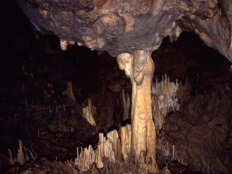
On the Simbruini Mounts there are many big karst hollows (also called "campi", meaning "fields"), such as "Campo Ceraso", "dell'Osso", "della Pietra" and in particular the Piano di Camposecco near Camerata Nuova. This is Simbruini Mounts' most fascinating upland, featuring many sinkholes and dolines, some of them being very large and deep. Through these superficial fissures water starts long underground journeys leading to the many water springs in the valley bottom. In the last few years several speleological groups from Lazio contributed to the speleological knowledge of this area. Simbruini Mounts' most famous cave is called Inferniglio, and it is situated at an altitude of 512 m above sea level in the municipality of Jenne. This system seems to drain the water between Campo dell'Osso and M.Livata, and it was the object of important underwater explorations. The 2,500-meters-high relief within the mountain, which one crosses by following upstream the course of an underground river, might show the existence of a great basic collector supplied through a complex underground network developing along dozens of kilometers. Other important cavities on the Simbruini mountains are the Pertuso di Trevi, near the artificial dam of the Aniene river, between Filettino and Trevi nel Lazio; the Pozzo della Creta Rossa (red clay pit) north of Jenne, the Camposecco sinkhole, the Grotta della Neve on the slopes of Mount Viglio and the Grotta degli Urli, which is about 600 m deep in the southwestern slope of Mount Agnello (Campocatino), just right on the border of the Park. The water of this cave emerges in the upper valley of the river Aniene. The hydrogeological researches carried out by the Circolo Speleologico Romano showed that the chemical tracer (fluorescein) applied into the final syphon of the Grotta degli Urli appears again by Trevi nel Lazio, about 8 km farther, in the Foce cave.
(The following links lead to Italian texts)