Ring-route 6. The Oia Valley and the upper Casentino
Camaldoli - La Burraia - La Chiusa - Camaldoli
- Trail Conditions: On foot
- Interest: Flora, Religion, Hystory
- Departure: Camaldoli
- Arrival: Camaldoli
- Duration: 6 h + 4,5 h + 4,5 h
- Difficulty Level: E - Hiking (level)
- Length: 29 km (11 km + 9,5 km + 8,5 km)
- Difference in height: uphill 650 m + 70 m + 36 m
- Public Means of Transport: BUS LINE LFH3 with departure from Poppi (Etruria Mobilità)
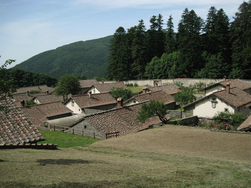
- Accomodation structures: Locanda Chalet Burraia, Rifugio C.A.I. Citta' di Forli', La Chiusa
An itinerary developing in the upper Casentino between Romagna and Tuscany: from the Camaldoli hermitage the itinerary will lead hikers to the Calla Pass and the Burraia meadows, walking along the ancient Legni Way, then again in Tuscany along the beautiful valley of the Oia stream. ![]() Download the description of the ring-route 6. (Italian text)
Download the description of the ring-route 6. (Italian text)
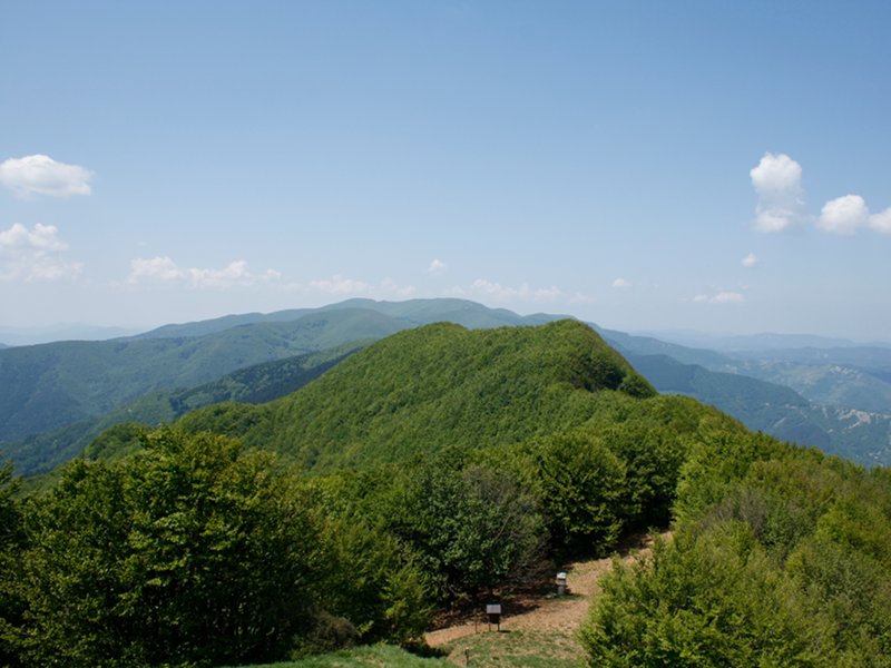
First day. From the Camaldoli Hermitage, on the left side of the entrance façade, the path runs alongside the walls and climbs up the fir forest up to the beech forests on the ridge. Once reached the watershed, the itinerary heads northwest and, except for some open areas - the biggest of which is Prato Bertone - hikers walk within the forest. In Poggio Scali one cannot miss the panoramic view from the summit, which is worth a small deviation: a large part of the Park is in front of us. Beyond this summit the path mainly climbs down, and the rise will start again only after the Calla Pass, by the wooden stall situated in this famous mountain pass. It takes only 20 minutes to reach the Burraia meadows, a plain representing a testimony to the ancient sheep-farming tradition and to the first ski facilities. On the summit of the meadows the panoramic view overlooks the green Casentino and the rugged hills of Romagna. Now you can choose where you prefer to spend your evening and night.
Second day. The second day's itinerary departs from the Burraia meadows. Heading Mount Gabrendo, not far from the Enel cabin, the path turns right, meets another power cabin and climbs down up to the Giogharello Pass. Turning right one walks a short stretch on the dirt road, then the path turns left and climbs down towards Poggio Morgante. Again one meets the road, but the path goes on on the opposite side, within the forest, up to the arrival point of Oio: a small house with a bivouac and tables nearby. Hikers will meet again the road seen before, but the path climbs down the trench, passes near a stable and goes on near the foaming stream. Near a wonderful chestnut forest the path crosses a tributary coming from the right side, then it goes on until it connects with a small road leading to Papiano's houses. Following the path on the right for about 200 m one will find the continuation of the path crossing the village of Stia, and then reaches the Calla road. This road can be walked for another kilometer on the left, up to the first bend in the locality of Gaviserri. On the right side the path 78 climbs down the trench and leads us to the locality of La Chiusa.
Third day. The last day of walk is characterized by a considerable difference in height uphill. From Chiusa one crosses Case Gaviserri, then the ruins in Volta dell'Acero. At this point the beech forest stands out, and on the ridges of Poggio La Mazza and of Cima Colletta one approaches Aia di Dorino, an important junction of routes. From this point we enter the uphill forestry road and walk it up to the Capanna Maremmana, by the Pian del Varco Trench. The main forest road climbs up on the left, but the itinerary enters the smaller trail on the right, which divides the slope and reaches the Croce Gaggi pass, where one will arrive after having turned left once reached the asphalted road. The last path is the number 74, which allows hikers to go beyond the ridge covered with firs and beeches separating us from the Sacred Hermitage, where this trekking ends.
Involved structures: Locanda Chalet La Burraia and Città di Forlì C.A.I. Mountain hut (first day), Agriturismo La Chiusa (second day)
 Download KMZ